Glossary
What the labels mean
SSSIs, National Landscapes, Munros, forces, fells and lochs: every designation, hill list and local word you'll meet in the Albion Guide, in plain English, with places to see each one.
One place, many labels
Most places in the Albion Guide wear more than one label, and the labels come from different organisations that each care about something different. One cares about wildlife, another about scenery, another about archaeology, and hill-walkers keep their own lists purely for the fun of ticking them off.
Take Scafell Pike. It's the highest mountain in England, which makes it Cumbria's county top. It's one of Alfred Wainwright's 214 Lakeland fells, and it also turns up on the Hewitt, Nuttall and Marilyn hill lists. It sits inside the Lake District National Park, which is also a UNESCO World Heritage Site, and the summit itself belongs to the National Trust.
Or Box Hill in Surrey. It's a National Trust viewpoint inside the Surrey Hills National Landscape, its chalk slopes are part of a Site of Special Scientific Interest, and the North Downs Way National Trail runs right over the top.
Stonehenge is a stone circle, a sort-of henge (more on that below), a scheduled monument and part of a World Heritage Site, all at once.
The labels overlap because they measure different things. An SSSI says a site matters to scientists, a National Park says a landscape matters to everyone, and a hill list just says a hill is high enough, or stands out enough, to count. None of them outranks the others, and none of them tells you whether a place makes a good day out. A patch of bog can be fiercely protected and not much to look at, while a lovely stretch of river may carry no label at all. That's why the Albion Guide adds a rating of its own, explained first below.
How the Albion Guide rates places
Our own labels, the ones you'll see on cards, lists and place pages.
- National iconIconic
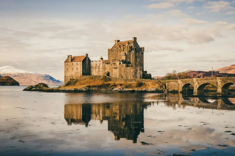
Eilean Donan Castle Our top rating, for places worth planning a whole trip around: the ones people cross the country to see. There are only a few hundred of them, and every one was chosen by hand after research, never by the computer.
For example: Eilean Donan Castle , Aysgarth Falls , High Force , Pistyll Rhaeadr
- Local highlightHighlight
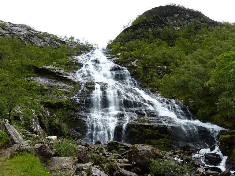
Steall Falls Worth a detour. The best places in their area, good enough to anchor a day out if you're anywhere nearby. These come from a scoring model that weighs up things like what there is to see, how well known a place is and whether you can actually get in, with editors free to overrule it.
For example: Steall Falls , Eas Mòr , Falling Foss , Bude Sea Pool
- Local gem
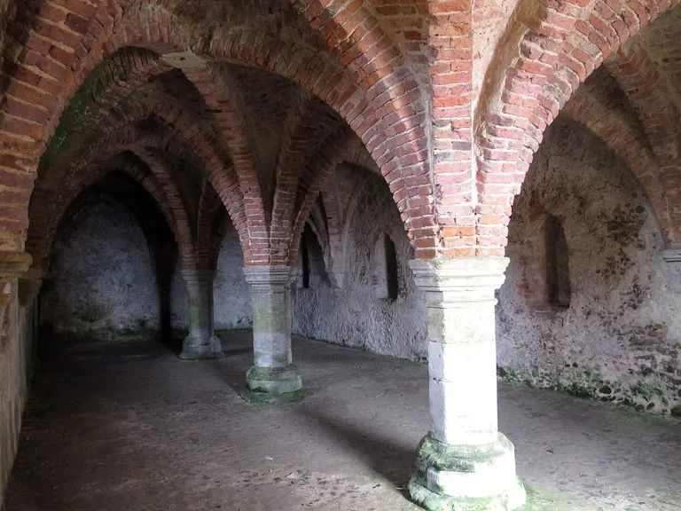
Blakeney Guildhall Worth a look. A pleasure if you're close by, even if you wouldn't drive across the county for it. Most of the good, quiet places in the Albion Guide sit here.
For example: Blakeney Guildhall, Cantlop Bridge, Chichele College, Higham Ferrers, Coombe Conduit
- Catalogued
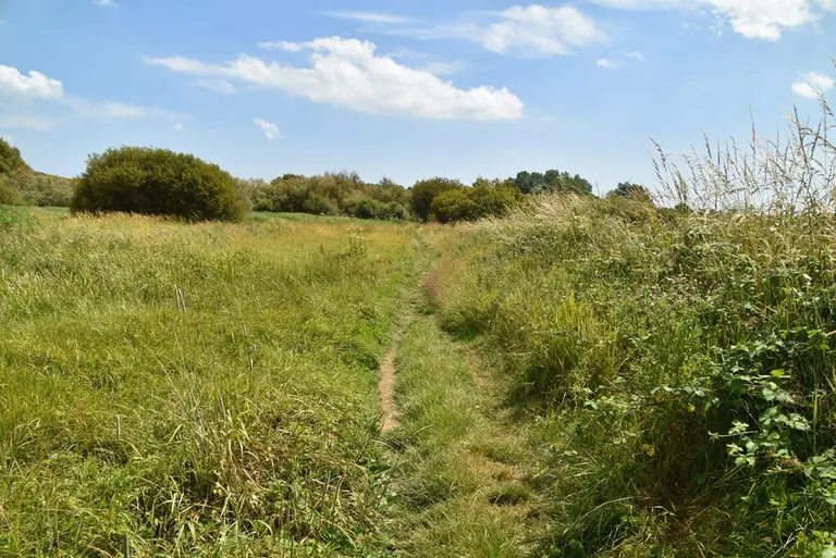
Filsham Reedbed On the map for the record. These are real places, often officially protected, but with little to see, no confirmed public access, or both: a fenced-off scrap of meadow, the buried site of a vanished priory, a monument that's now a grassy bump in a field. We list them because people look them up, but we won't pretend they're a day out.
For example: Filsham Reedbed, Bodiam, Kirkcaldy, Abinger Hammer
- Open access
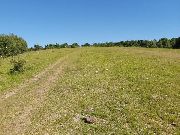
Box Hill Country Park You're free to walk in without paying or booking, at any reasonable time. That might be because the land has a legal right of access (see the right to roam, below), because it's a National Nature Reserve, country park or National Trust land left open for wandering, or because the place is simply open to anyone. Being inside a National Park or National Landscape doesn't count on its own: most of the land in them is private.
For example: Box Hill Country Park , Castlerigg stone circle , Kinder Scout
- Open to visitors
Eilean Donan Castle You're welcome, but on the owner's terms: there's a gate, an admission charge, set opening times or all three. Castles, stately homes, many gardens, and the places run by the National Trust, English Heritage, Cadw and Historic Environment Scotland mostly work this way. Check the official website for opening times and prices before you travel.
For example: Eilean Donan Castle , Bodiam Castle , Chatsworth House
- Access unclear
We haven't been able to confirm that the public can get in. It doesn't mean the place is closed: plenty of these can be seen from a nearby footpath or road, and some are open on a few days a year. Check locally before you set out.
- Standing, ruins, earthworks or nothing visible
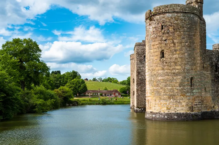
Bodiam Castle For historic sites we say honestly how much is left. Standing remains means a building you can walk up to and look at. Substantial ruins means roofless, but with plenty still above ground. Earthworks only means banks, ditches and platforms in the grass, with no walls, so you're reading the shape of the ground. Nothing visible means the remains survive underground, and there's nothing to see on site at all.
For example: Bodiam Castle , Fountains Abbey , Old Sarum , Maiden Castle
Protected landscapes and wildlife sites
Official designations for scenery and nature. Most are the job of three government bodies: Natural England, Natural Resources Wales and NatureScot in Scotland.
- National Park
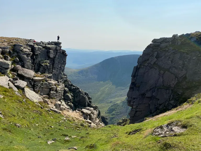
Cairngorms The biggest and best-known protection for landscape. A National Park is a large area of countryside protected for its natural beauty, wildlife and heritage, and for people to enjoy. Each one has its own authority that sets the planning rules, which is why new building inside a park is tightly controlled.
National Parks aren't wilderness and they aren't owned by the government. People live and farm in them, and most of the land is privately owned. Britain's first was the Peak District, in 1951. There are 15 in all: ten in England, three in Wales and two in Scotland.
For example: Cairngorms , Eryri , Lake District , Loch Lomond & The Trossachs
- National Landscapeformerly Area of Outstanding Natural Beauty (AONB)
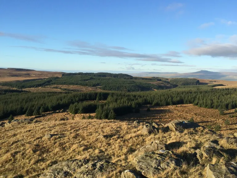
Forest of Bowland Countryside judged so special that its scenery is protected to the same standard as a National Park, just without a park authority of its own. Local councils and a dedicated team look after each one instead.
Until late 2023 these were called Areas of Outstanding Natural Beauty. AONB is still the legal term, and you'll see it on older signs and maps. They tend to be gentler, more lived-in landscapes than the National Parks: the Cotswolds, the Chilterns, the High Weald. There are 38 across England and Wales. Northern Ireland has eight more, which are still called AONBs.
For example: Forest of Bowland , Cotswolds , North Pennines , North Wessex Downs
- National Scenic AreaNSA
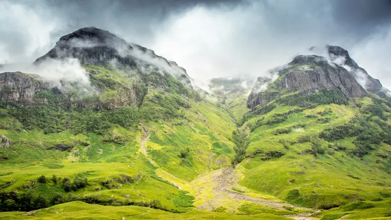
Ben Nevis and Glen Coe Scotland's version of a National Landscape. There are 40 National Scenic Areas, picked out for outstanding scenery, and together they cover a big share of the Highlands and islands, from Glen Coe to St Kilda. Like National Landscapes, they mainly shape what can be built rather than managing the land day to day.
For example: Ben Nevis and Glen Coe , The Cairngorm Mountains , The Cuillin Hills , The Trossachs
- Heritage Coast
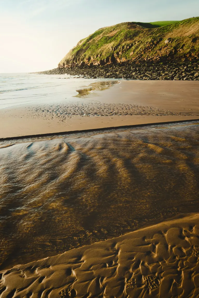
St Bees Head A stretch of largely undeveloped coast in England or Wales that's been picked out for its beauty and managed to keep it that way, with footpaths, conservation work and a light hand on building. Heritage Coasts often overlap with National Parks or National Landscapes. The white cliffs of the Seven Sisters are part of one.
For example: St Bees Head , Spurn , Purbeck , Rame Head
- Site of Special Scientific InterestSSSI
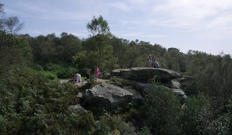
Brimham Rocks An SSSI is land that scientists have judged important enough to protect by law, for its wildlife, its plants, its rocks or its landforms. Natural England chooses them in England, Natural Resources Wales in Wales, and NatureScot in Scotland. Owners can't damage the special features without permission, which is how a meadow full of rare orchids stays a meadow.
They come in every size. Some are tiny, like a single old quarry face where a layer of rock is exposed. Others are enormous: the Humber Estuary SSSI covers around 37,000 hectares, and whole rivers like the chalk-fed River Itchen in Hampshire are SSSIs from end to end.
An SSSI isn't a promise of a good day out. Plenty are beautiful, but some protect a patch of bog a particular insect likes, and many are on private farmland with no public access at all. There are over 4,000 in England alone, which is why most of them show as Catalogued in the Albion Guide. Northern Ireland has its own version, called an Area of Special Scientific Interest.
For example: Brimham Rocks , Long Mynd , The Malvern Hills , Alderley Edge
- National Nature ReserveNNR
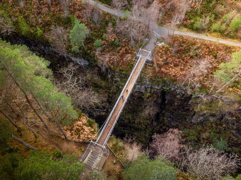
Corrieshalloch Gorge The best wildlife sites in the country, protected and managed specifically for nature, and usually open to visitors. Where an SSSI can be a private field, an NNR is typically run by a conservation body with paths, signs and sometimes a warden. Britain's first was Beinn Eighe in Wester Ross, declared in 1951.
For example: Corrieshalloch Gorge , Golitha Falls , Blakeney , Wistman's Wood
- Country park
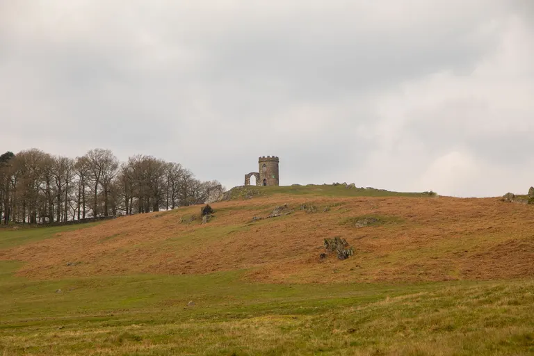
Bradgate Park and Swithland Woods Countryside set aside close to towns so people can get outdoors easily, usually with a car park, paths, toilets and often a café. Most were created by local councils from the late 1960s onwards. They're about access and fresh air rather than rare wildlife, though many are lovely.
For example: Bradgate Park and Swithland Woods , Broadway Tower , Cragside Country Park , Humber Bridge Country Park
- Ancient woodland
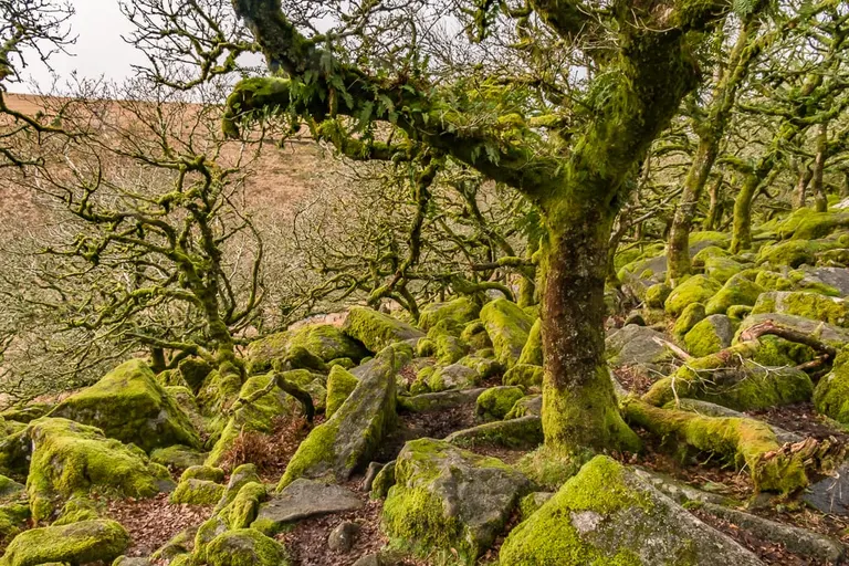
Wistman's Wood Land that's been wooded continuously since at least 1600 in England and Wales (1750 in Scotland, where the first good maps date from). The trees themselves may be younger, but the soil, fungi and woodland plants have gone undisturbed for centuries, and that can't be recreated by planting. We show ancient woodland as a background layer on the map rather than as individual pages, though some of the best-known old woods have pages of their own.
For example: Wistman's Wood , Hatfield Forest, Sherwood Forest
- RSPB reserve
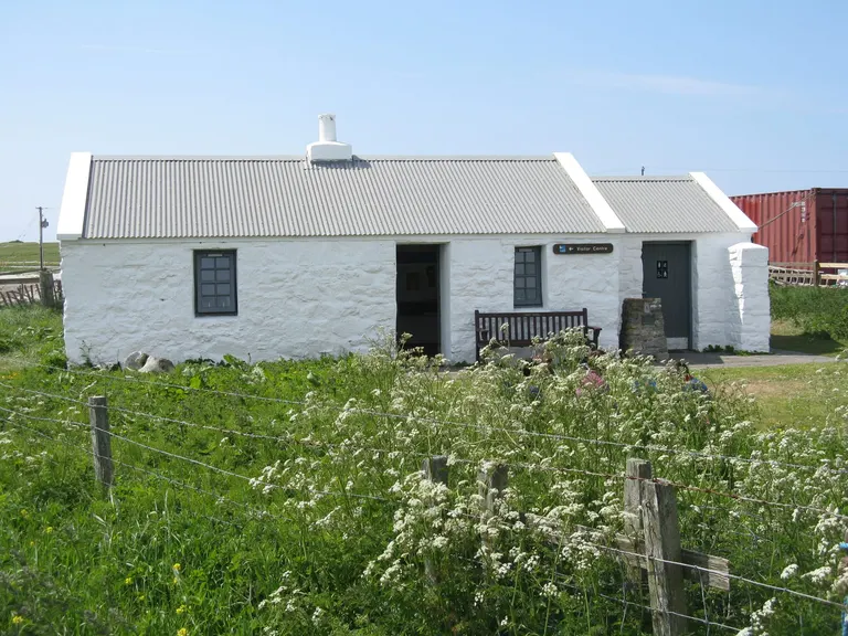
Balranald RSPB Nature Reserve A nature reserve owned or managed by the RSPB, the Royal Society for the Protection of Birds, the UK's biggest nature charity. Most welcome visitors, with hides, trails and often a visitor centre.
For example: Balranald RSPB Nature Reserve , RSPB Loch Ruthven , RSPB Udale Bay , RSPB Ynys-hir
- Designated bathing water
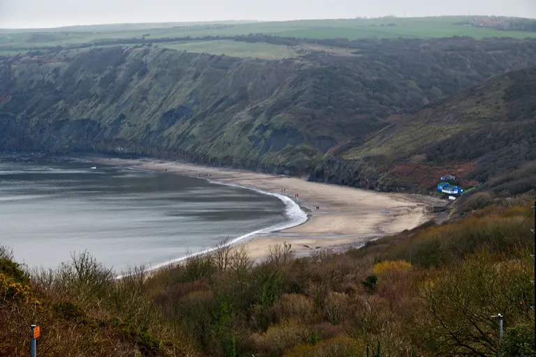
Runswick Bay A beach or inland swimming spot that's officially tested for water quality through the swimming season, which runs from mid-May to the end of September in England and Wales, and from 1 June to 15 September in Scotland. Each one gets a yearly rating of Excellent, Good, Sufficient or Poor. A designation means the water gets checked, not that it's always clean, so it's worth looking at the latest rating and any warnings after heavy rain.
For example: Runswick Bay , Bamburgh Beach , Durdle Door , Hartland Quay
- Lidosea pool, tidal pool
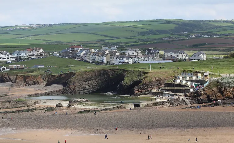
Bude Sea Pool An open-air public swimming pool. The word comes from the Lido, the long beach island at Venice, and most of Britain's lidos were built between the two world wars, many in an Art Deco style. The Albion Guide files tidal sea pools with them: pools walled or cut into the rocks on the shore and refilled by the sea at high tide, usually free and unheated. Lidos keep seasons and only some are heated, so each page says when it opens and how warm the water is.
For example: Bude Sea Pool , Beccles Lido , Brightlingsea Lido , Bristol Lido
- Right to roamopen access land
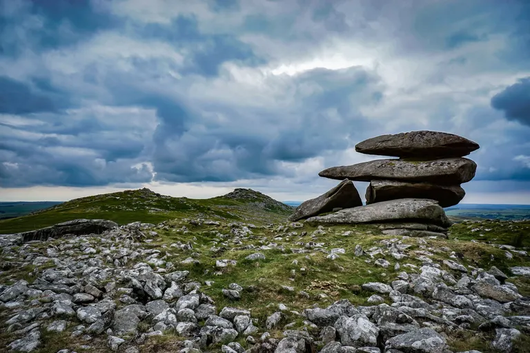
Dartmoor In England and Wales, a law passed in 2000 gives you the right to walk freely across mapped areas of mountain, moor, heath, down and registered common land, off the paths as well as on them. Ordnance Survey maps shade it in yellow. Scotland goes much further: under a 2003 law, in force since 2005, you can go almost anywhere on foot, as long as you behave responsibly, under the Scottish Outdoor Access Code.
For example: Dartmoor , Kinder Scout , Cairngorms
- World Heritage Site
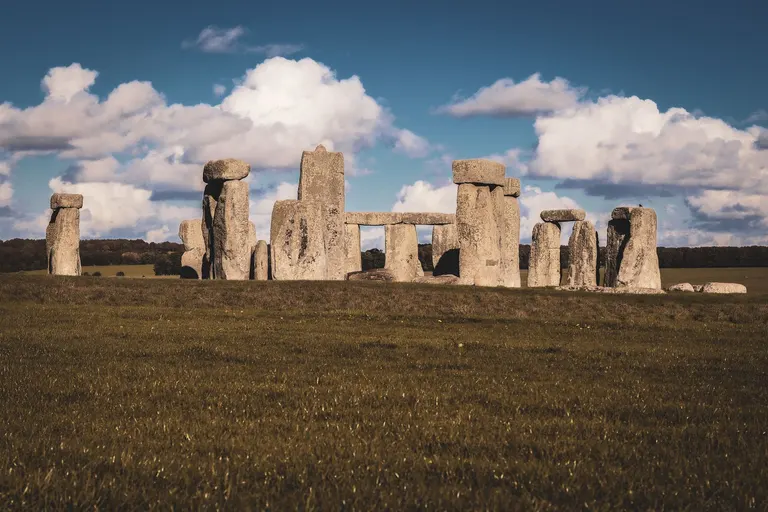
Stonehenge A place UNESCO has judged to matter to the whole of humanity. The UK has over 30, a mix of landscapes and monuments: Stonehenge and Avebury, Hadrian's Wall, the Lake District, the Jurassic Coast and St Kilda among them.
For example: Stonehenge , Lake District , Durdle Door , St Kilda
History and heritage designations
How the country's old buildings and archaeology are protected. Historic England, Cadw (in Wales) and Historic Environment Scotland keep the official lists.
- Scheduled monument
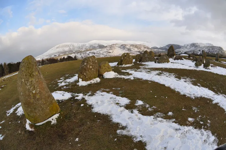
Castlerigg stone circle An archaeological site or ruin judged nationally important and protected by law, so nobody can dig, build or even use a metal detector on it without permission. The list runs from Stone Age burial mounds to Cold War bunkers, and there are around 20,000 in England. Most of the castles, abbeys, Roman sites and ancient monuments in the Albion Guide are scheduled. Being scheduled says nothing about public access: many are on private farmland.
For example: Castlerigg stone circle , Calanais Standing Stones , Avebury , Penshaw Monument
- Listed buildingGrade I, II* and II
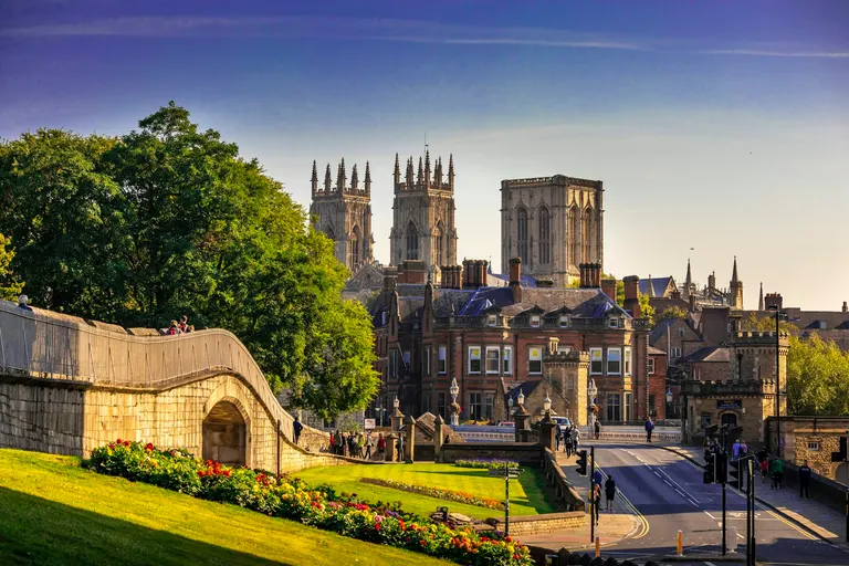
York Minster A building protected for its architectural or historic interest, so changing or demolishing it needs special permission. In England and Wales there are three grades. Grade I is for buildings of exceptional interest, only a few per cent of the total. Grade II* is for particularly important buildings with more than special interest. Grade II covers everything else on the list, which is the great majority. Scotland uses categories A, B and C in much the same way.
For example: York Minster , Ely Cathedral , Bodiam Castle
- Registered park and garden
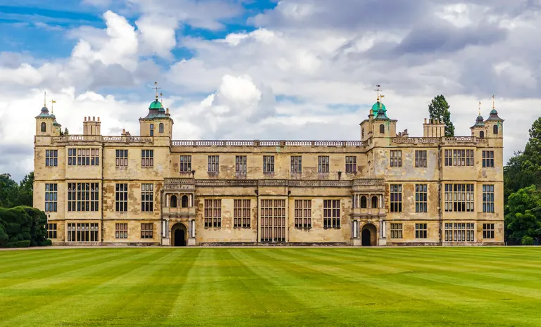
Audley End House and Gardens A designed landscape, such as a country-house park, a landscape garden, a Victorian public park or a cemetery, recorded on Historic England's Register of Parks and Gardens (Cadw keeps the Welsh one) and graded I, II* or II like listed buildings. The grades you see on our house and garden pages come from this register. Being registered doesn't mean a garden is open to the public, so check before you go.
For example: Audley End House and Gardens , Hardwick Hall , Lyme Park , Osborne House
- Registered battlefield
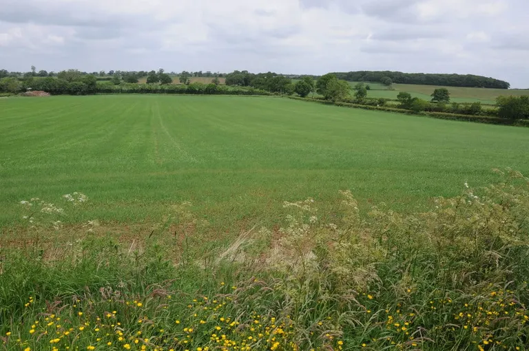
Battle of Naseby A battle site recorded on Historic England's Register of Historic Battlefields, or Scotland's Inventory of Historic Battlefields, where the fighting's location is known well enough to map. Most are farmland today, and the interest is in standing where it happened and reading the ground.
For example: Battle of Naseby , Battle of Bannockburn , Battle of Hastings, Battle of Lewes
- National Trust
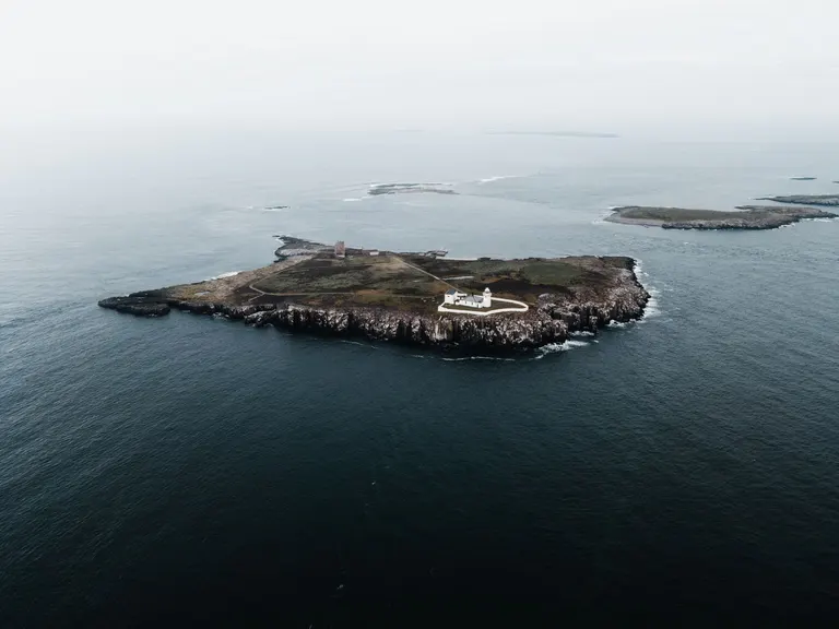
Farne Islands A charity founded in 1895 to look after places of historic interest and natural beauty for everyone, for ever. It now cares for hundreds of houses, gardens and castles and a huge amount of coast and countryside in England, Wales and Northern Ireland. Much of its countryside is free to walk. Its houses and gardens usually charge admission, free to members. Scotland has a separate charity, the National Trust for Scotland.
For example: Farne Islands , St Michael's Mount , Dunster Castle , Lundy
Hill lists
Hill-walkers love a list. Each one below is a way of deciding which hills count, usually by height plus drop, which is how far you have to go down before climbing to anything higher. Collecting the tops on a list is called bagging.
Scotland
- Munros over 3,000 ft · any drop
- Corbetts 2,500–3,000 ft · 152 m drop
- Grahams 2,000–2,500 ft · 150 m drop
- Marilyns any height · 150 m drop
England & Wales
- Nuttalls over 2,000 ft · 15 m drop
- Hewitts over 2,000 ft · 30 m drop
- Marilyns any height · 150 m drop
- Munro
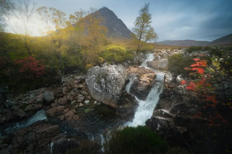
Buachaille Etive Mòr (Stob Dearg) A Scottish mountain over 3,000 feet (914 metres). They're named after Sir Hugh Munro, who published the first list in 1891, and today there are 282. Climbing them all is called compleating (with that spelling), and the people who have done it are Munroists.
For example: Buachaille Etive Mòr (Stob Dearg) , Ben Nevis , Schiehallion , Ben Lomond
- Corbett
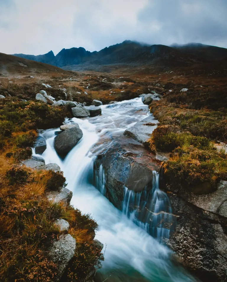
Caisteal Abhail A Scottish mountain between 2,500 and 3,000 feet (762 to 914 metres) with at least 500 feet (152 metres) of drop on every side, so each one is a proper standalone hill. There are 222. Plenty of Corbetts are better climbs than their bigger neighbours.
For example: Caisteal Abhail , The Cobbler , Ben Loyal , Goatfell
- Graham
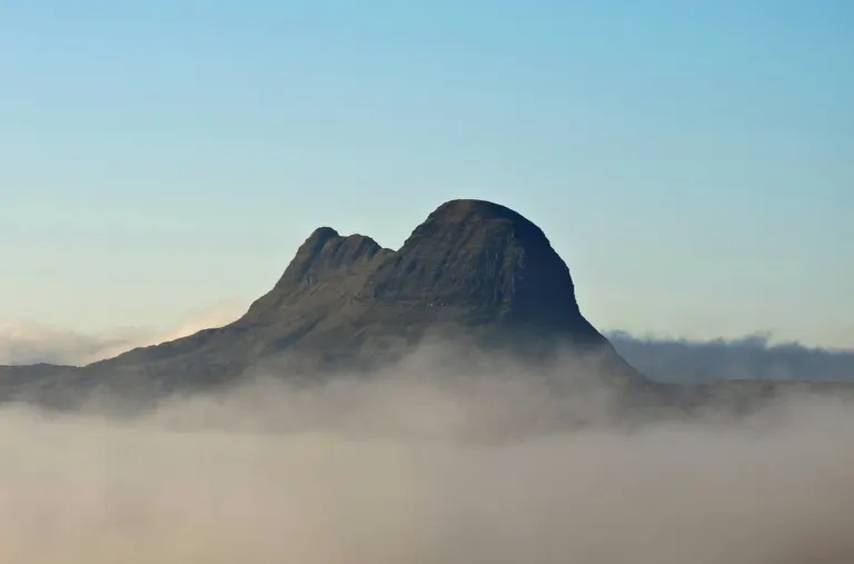
Suilven A Scottish hill between 2,000 and 2,500 feet (610 to 762 metres) with a drop of at least 150 metres all round. There are 231.
For example: Suilven , Stac Pollaidh , Ben Venue , The Storr
- Donald
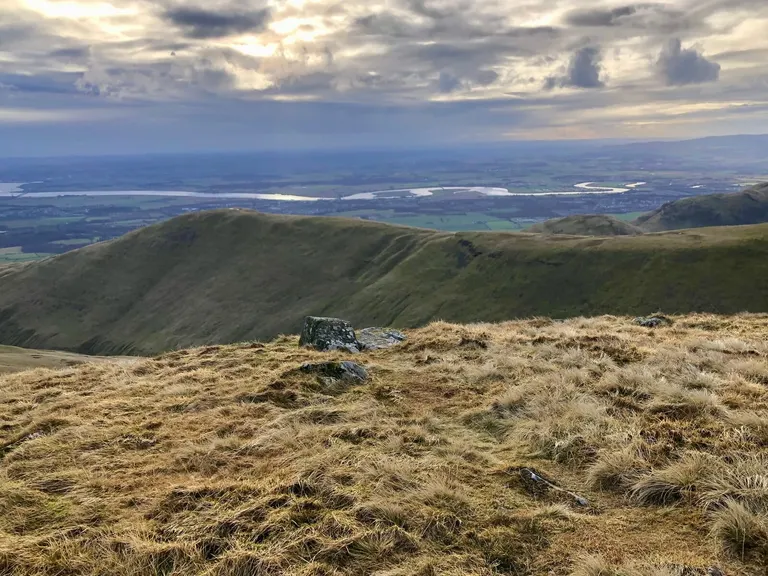
Ben Cleuch A hill in the Scottish Lowlands, south of the Highlands, over 2,000 feet (610 metres). The list was drawn up by Percy Donald in the 1930s.
For example: Ben Cleuch, Broad Law, Cairnsmore of Carsphairn, Carlin's Cairn
- Marilyn
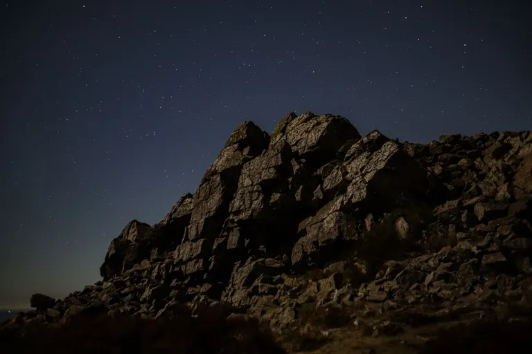
Stiperstones Any hill in Britain or Ireland, of any height, with at least 150 metres of drop all round. The name is a joke: a play on the Munros and Marilyn Monroe. Because height doesn't matter, the list takes in sea stacks and low island hills as well as big mountains, which makes it a great excuse to visit odd corners of the country.
For example: Stiperstones , Glyder Fawr , Helvellyn , Scafell Pike
- Hewitt
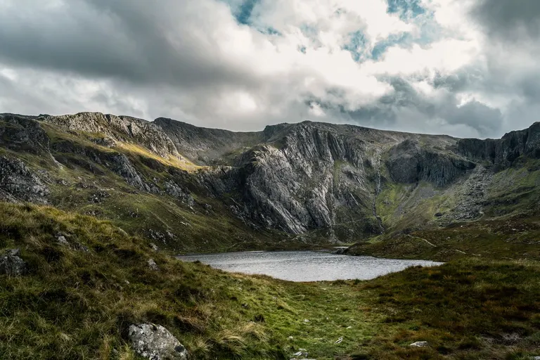
Cadair Idris A hill in England, Wales or Ireland over 2,000 feet (610 metres) with at least 30 metres of drop. The name spells out the rule: Hills in England, Wales and Ireland over Two Thousand feet.
For example: Cadair Idris , Blencathra , Bowfell , Crib Goch
- Nuttall
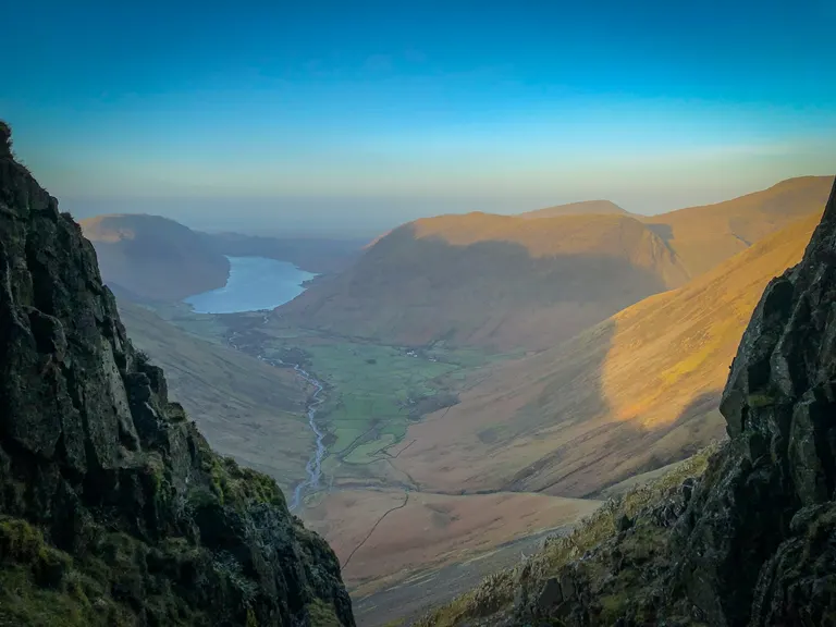
Great Gable A hill in England or Wales over 2,000 feet (610 metres) with at least 15 metres of drop, so the list is longer and fussier than the Hewitts. It's named after John and Anne Nuttall, who drew it up.
For example: Great Gable , Pen y Fan , Skiddaw , The Old Man of Coniston
- Wainwright
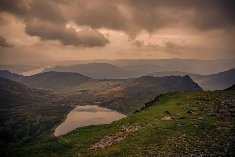
Helvellyn One of the 214 Lake District fells described in Alfred Wainwright's seven hand-drawn Pictorial Guides to the Lakeland Fells, published between 1955 and 1966. His books are still in print and still carried up the fells, and many walkers set out to climb all 214.
For example: Helvellyn , Cat Bells , Haystacks , Hindscarth
- Wainwright Outlying Fell
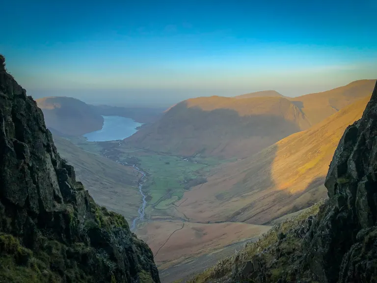
Pikes One of the lower, quieter hills around the edge of the Lake District that Wainwright described in a later book, The Outlying Fells of Lakeland. They're good walks for a short day or poor weather.
For example: Pikes , Gummer's How , Orrest Head, Black Combe
- County top
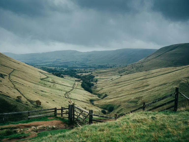
Kinder Scout The highest point in a county. Some are grand mountains; some are a slight rise in a field or a spot in a wood, which is half the fun of collecting them.
For example: Kinder Scout , Whernside , Yr Wyddfa , The Wrekin
- Trig pillartrig point
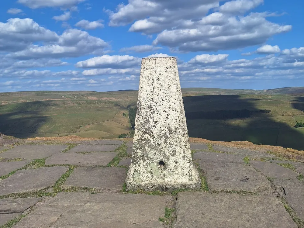
A trig pillar in the Peak District The squat concrete pillars you find on hilltops. Ordnance Survey built thousands of them from 1936 onwards to map Great Britain accurately, taking angle measurements from one pillar to the next. Satellites made them redundant, but they've become a favourite summit marker, and plenty of walkers collect those too.
For example: Yr Wyddfa
Routes
- National Trail
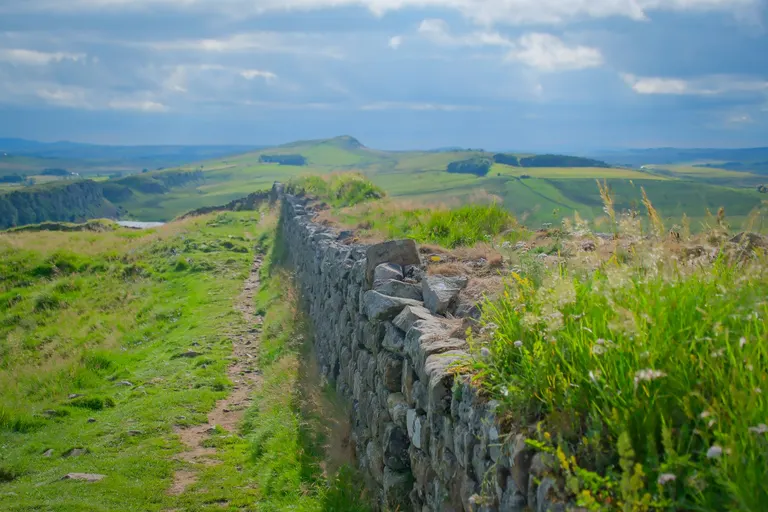
Hadrian's Wall Path The top tier of long-distance walking routes in England and Wales, funded by government, waymarked with an acorn symbol and kept in good order. The first, the Pennine Way, opened in 1965. Others include the South West Coast Path and Offa's Dyke Path.
For example: Hadrian's Wall Path , Coast to Coast , Pennine Bridleway , Pennine Way
- Scotland's Great Trail
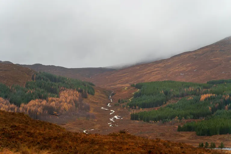
Southern Upland Way Scotland's family of waymarked long-distance routes, 29 of them, from the West Highland Way, which opened in 1980 as Scotland's first, to routes you can do in a long weekend.
For example: Southern Upland Way , Fife Coastal Path , John Muir Way , Great Glen Way
- Long-distance path
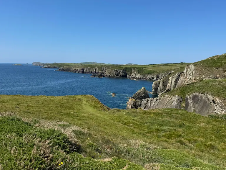
Wales Coast Path Any other named walking route that takes more than a day or two, usually looked after by councils, charities or volunteers rather than national funding. Waymarking varies, so a map is a good idea.
For example: Wales Coast Path , Cambrian Way , Hardy Way , Hertfordshire Way
- Canal
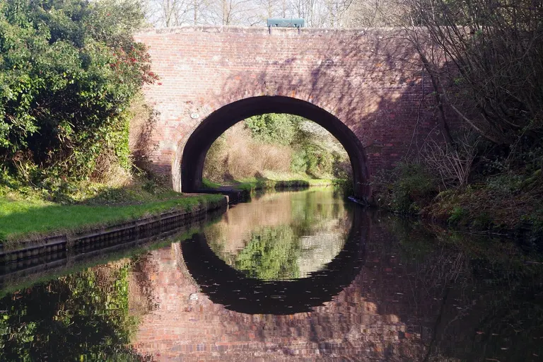
Stratford-upon-Avon Canal A waterway dug by hand, most of them between the 1760s and the 1830s, to carry goods by boat before the railways came. Today they're used mostly by narrowboats, walkers and cyclists, and the towpaths make easy, flat walking.
For example: Stratford-upon-Avon Canal , Grand Union Canal , Kennet & Avon Canal , Leeds & Liverpool Canal
- River navigation
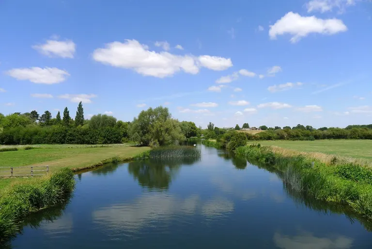
River Nene A natural river made usable by boats, with locks, weirs and short cuts dug to bypass the awkward bits. The difference from a canal is that a navigation mostly follows the river rather than an entirely man-made channel.
For example: River Nene , River Thames , River Trent , River Wye
Ancient sites
Most of these date from the Stone Age (the Neolithic, roughly 4000 to 2500 BC), the Bronze Age (to about 800 BC) and the Iron Age (to the Roman invasion in AD 43).
- Stone circle
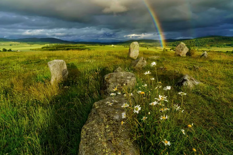
Tomnaverie A ring of standing stones, most of them put up between about 3000 and 1500 BC. Nobody knows for sure what they were for, though many line up with the sunrise or sunset at midsummer or midwinter, and they were probably places for gatherings and ceremonies.
For example: Tomnaverie , Ring of Brodgar , Long Meg and Her Daughters , Mitchell's Fold stone circle
- Henge
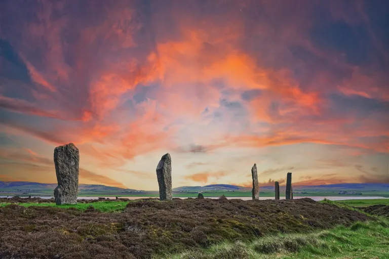
Ring of Brodgar A round earthwork with a bank and a ditch, where the ditch is on the inside of the bank. That's backwards for defence, which is one reason archaeologists think henges were ceremonial. The word comes from Stonehenge, which, confusingly, doesn't fit the rule, as its ditch is outside the bank.
For example: Ring of Brodgar , Stenness , Bryn Celli Ddu , Knowlton Church and Earthworks
- Standing stonemenhir
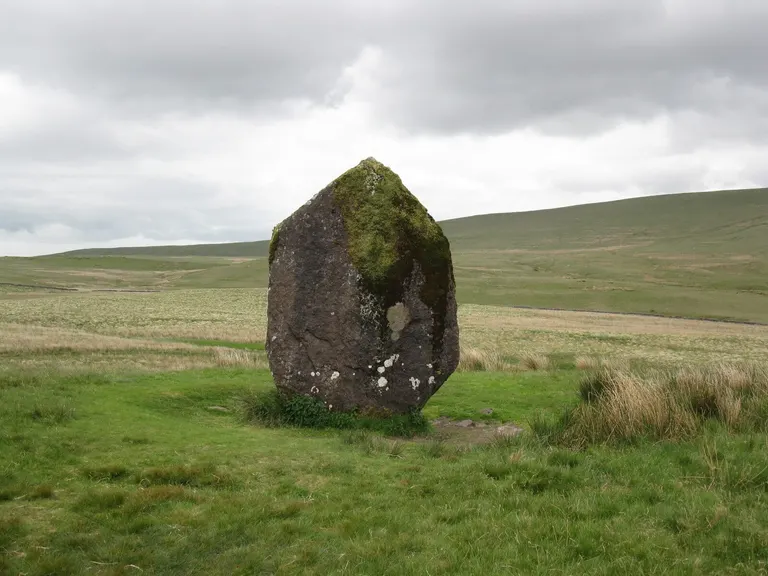
Maen Llia A single upright stone set up in prehistory, often in a place with a wide view. Some mark burials or boundaries; for most, the purpose is lost.
For example: Maen Llia , The Rudston Monolith , St Breock Downs Monolith, Penrhosfeilw Standing Stones
- Stone row
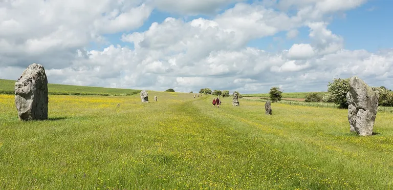
West Kennet Avenue A line of small standing stones, sometimes running for hundreds of metres. Dartmoor has more of them than anywhere else in Britain.
For example: West Kennet Avenue , Merrivale Prehistoric Settlement , Upper Plym Valley, Yar Tor
- Chambered tombpassage grave, chambered long barrow
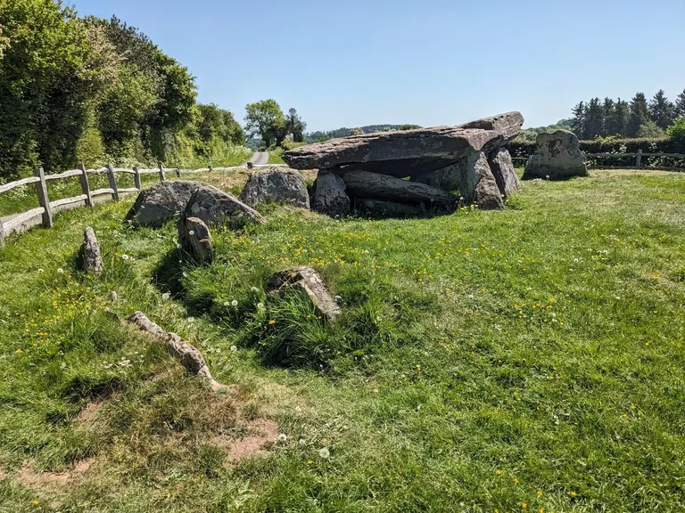
Arthur's Stone A Stone Age communal grave: a chamber built of big slabs of stone, covered by a mound of earth or stones, where people placed their dead over many generations. Some you can walk right into.
For example: Arthur's Stone , Pentre Ifan , Dwarfie Stane, Hoy , Llugwy Chambered Tomb
- Barrowprehistoric mound, tumulus, cairn
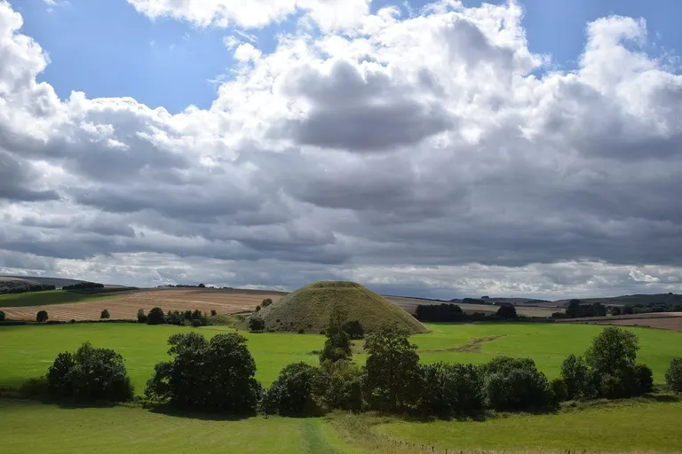
Silbury Hill A burial mound. Round barrows are mostly Bronze Age and often come in clusters on hilltops and ridges. You'll see them marked as tumuli on Ordnance Survey maps.
For example: Silbury Hill , Hob Hurst's House, Winterbourne Poor Lot Barrows, Flowerdown Barrows
- Cursus
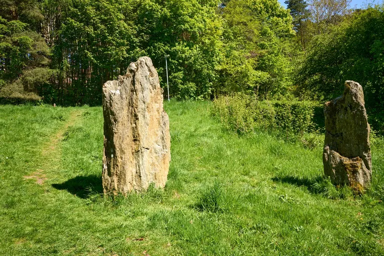
Long Meg and Her Daughters A pair of long, parallel banks with ditches, sometimes running for miles, built in the Stone Age. The name is Latin for racecourse, from an 18th-century guess about the one near Stonehenge. Their real purpose is still debated.
For example: Long Meg and Her Daughters , Dorset Cursus, Earth circles, Dorset Cursus, Bottlebush Down
- Rock artcup and ring marks
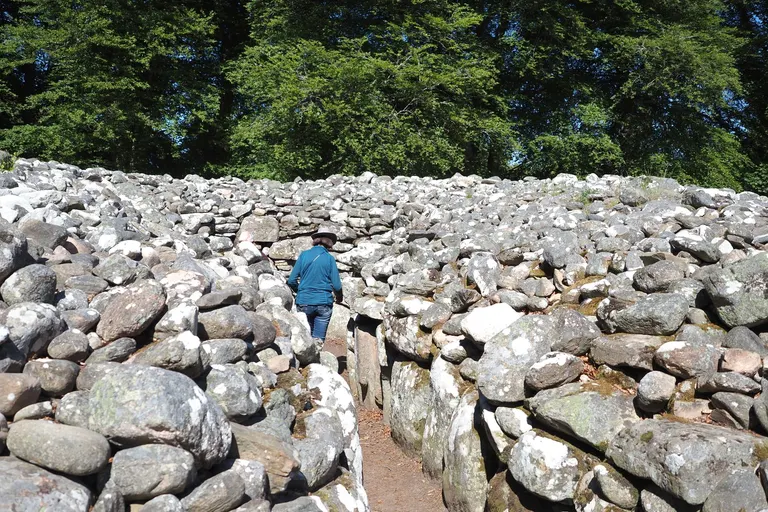
Clava Cairns Patterns pecked into natural rock by people in the Neolithic and Bronze Age, most often small cups surrounded by rings. They're common in Northumberland, Yorkshire and Argyll, and easy to miss unless the light is low.
For example: Clava Cairns , Achnabreck Cup & Ring Mark Rocks, Ballygowan Cup & Ring Mark Rocks, Baluachraig Cup & Ring Mark Rocks
- Hillfort
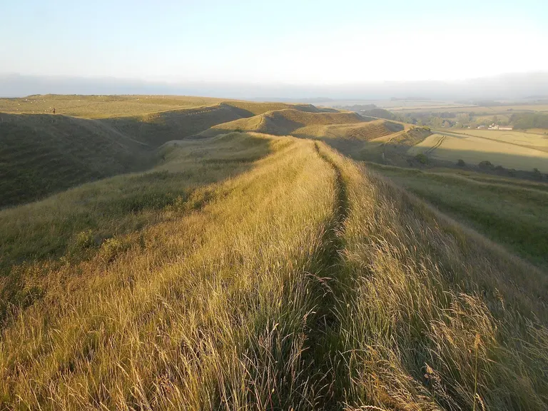
Maiden Castle A hilltop ringed by banks and ditches, mostly from the Iron Age. Some were defended villages, some were probably seasonal meeting places, and the biggest, like Maiden Castle in Dorset, are vast. Today they're mostly grassy ramparts with superb views.
For example: Maiden Castle , British Camp (Herefordshire Beacon), Pen y Crug, Caer Drewyn
- Promontory fort
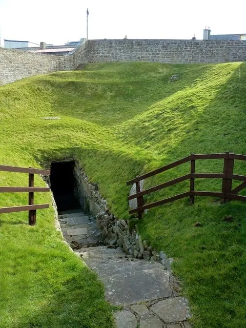
Burghead Promontory and Well An Iron Age fort built on a headland or spur, where cliffs or steep slopes protect most sides and only the neck of land needed banks and ditches across it. Many are on the coast.
For example: Burghead Promontory and Well , Black Head Fort, Bolt Tail Camp, Boltby Scar promontory fort
- Broch
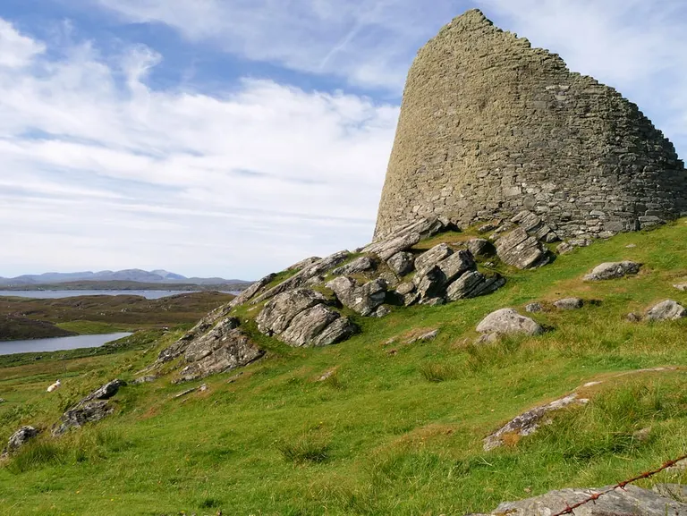
Dun Carloway A tall, round, drystone tower from the Iron Age, found only in Scotland, mostly in the far north and the islands. The walls are hollow, with a staircase inside them. The Broch of Mousa in Shetland still stands over 13 metres high.
For example: Dun Carloway , Jarlshof , Mousa , Aiker Ness, Broch of Gurness
- Dun
A Scottish Iron Age fort or fortified homestead, smaller than a hillfort, with thick drystone walls. It's the Gaelic word for fort, and you'll find it in lots of place names beginning Dun-.
For example: Kilpatrick Dun, Torr a'Chaisteal, Arran
- Crannog
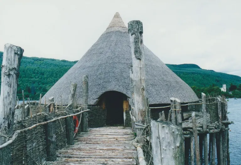
The Scottish Crannog Centre An artificial island built in a loch or lake as a home, used in Scotland and Ireland from prehistory into the Middle Ages. Many survive as small wooded islands.
For example: The Scottish Crannog Centre , Dun, Eilean Loch Arnol
- Souterrainearth house, fogou
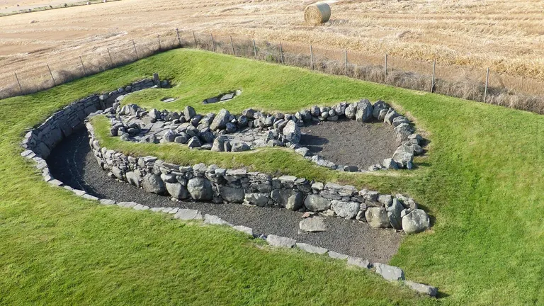
Ardestie Souterrain An underground passage lined with stone, built in the Iron Age, probably for storage. In Britain, Scotland has the most; in Cornwall they're called fogous.
For example: Ardestie Souterrain, Carlungie Souterrain, Halliggye Fogou, Castlelaw Fort
- Pictish stone
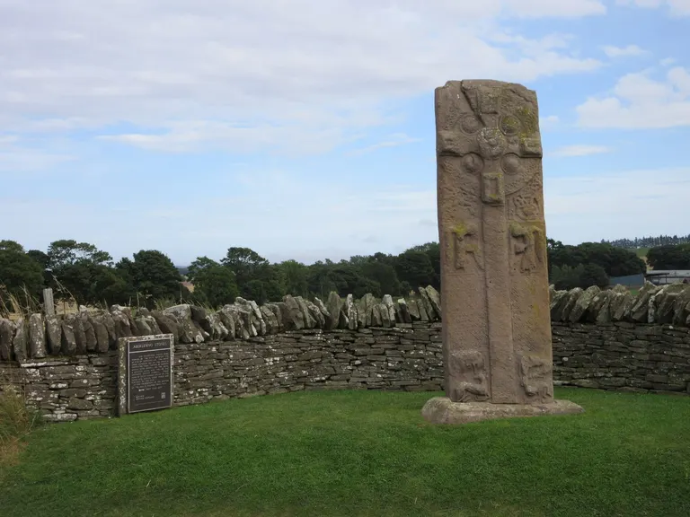
Aberlemno A carved stone made by the Picts, the people of north and east Scotland in the centuries after the Romans. They're covered in symbols (animals, crescents, combs and mirrors) whose meaning is still a puzzle, and the later ones also carry Christian crosses.
For example: Aberlemno , Aberlemno churchyard, Abernethy Round Tower, Brandsbutt Stone
- Flint mine
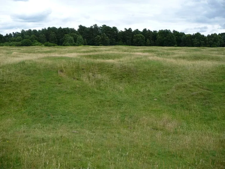
Grime's Graves Stone Age mine shafts dug down through chalk to reach good flint for axes and tools. At Grime's Graves in Norfolk you can climb down into one.
For example: Grime's Graves
Roman Britain
The Romans ruled much of Britain from AD 43 until around AD 410.
- Roman fort
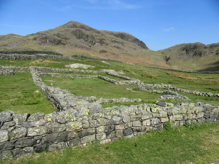
Hardknott Roman fort A permanent base for a unit of soldiers, laid out to a standard playing-card shape with barracks, a headquarters and granaries inside stone or turf walls. Many towns grew up around them.
For example: Hardknott Roman fort , Vindolanda , Brougham Castle and Roman fort , Chesters Roman Fort
- Roman campmarching camp
A temporary enclosure an army on the move dug for a night or a season. Usually all that's left is a faint bank and ditch, often spotted from the air.
For example: Bagraw Roman camp, Brown Dikes Roman temporary camp, Brown Moor Roman temporary camp, Chapel Rigg Roman temporary camp
- Roman villa
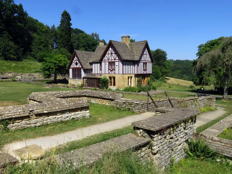
Chedworth Roman villa A country house at the centre of a farming estate, often with mosaic floors, heating under the floor and its own bath suite. The best let you see the mosaics where they were laid.
For example: Chedworth Roman villa , Fishbourne Roman Palace , Great Witcombe Roman Villa, Beadlam Roman Villa
- Frontier wall
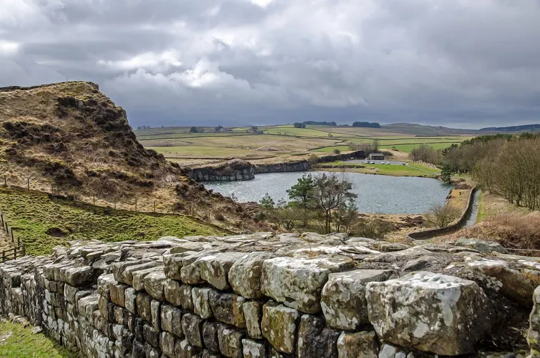
Cawfields Roman Wall The Romans built two walls across northern Britain: Hadrian's Wall from about AD 122, running coast to coast from the Solway to the Tyne, and the turf-built Antonine Wall further north in Scotland, about 20 years later.
For example: Cawfields Roman Wall , Antonine Wall , Birdoswald , Great Chesters
- Milecastle
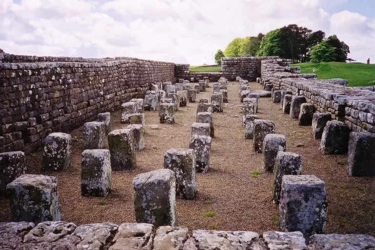
Housesteads fort A small fort built every Roman mile along Hadrian's Wall, with a gateway through the wall and room for a handful of soldiers.
For example: Housesteads fort , Harrow's Scar Milecastle, Poltross Burn Milecastle, Birdoswald
- Signal station
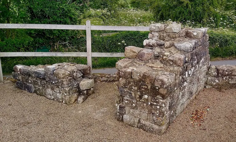
Pike Hill Signal Tower A Roman watchtower, most famously a chain along the Yorkshire coast built late in Roman rule to warn of raiders coming by sea.
For example: Pike Hill Signal Tower, Scarborough Castle, Ardunie Roman signal station, Kirkhill Roman signal station
Castles, abbeys and churches
- Motte and bailey
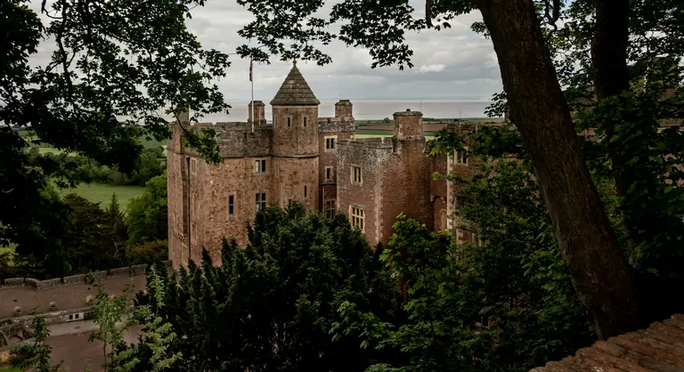
Dunster Castle The earliest kind of Norman castle, thrown up quickly after 1066. The motte is a big earth mound with a tower on top; the bailey is a fenced yard beside it. Most have lost their timber buildings and survive as a steep grassy mound.
For example: Dunster Castle , Bolsover Castle , Kenilworth Castle , Burrow Mump
- Ringwork
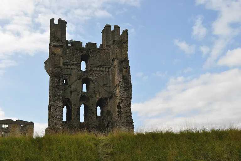
Helmsley Castle An early Norman castle made of a ring of bank and ditch, without the mound of a motte.
For example: Helmsley Castle , Kendal Castle, Ludgershall Castle, Bletchingley castle
- Tower housepele tower
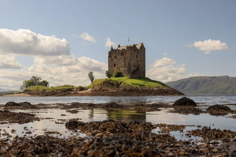
Castle Stalker A fortified home built as a tall stone tower, with the rooms stacked on top of one another. They're everywhere in Scotland and along the English border, where raiding was a way of life for centuries.
For example: Castle Stalker , Craigievar Castle , Smailholm Tower , Black Middens Bastle House
- Artillery fort
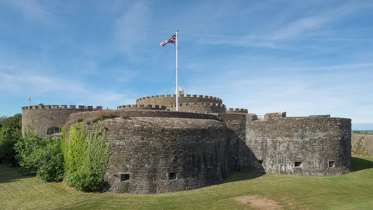
Deal Castle A low, squat fort built to carry cannon rather than keep out knights, most famously the chain Henry VIII built along the south coast around 1540 when he feared invasion by France and the Holy Roman Emperor, Charles V, who also ruled Spain.
For example: Deal Castle , Walmer Castle and Gardens , Pendennis Castle , Camber Castle
- Abbey and priory
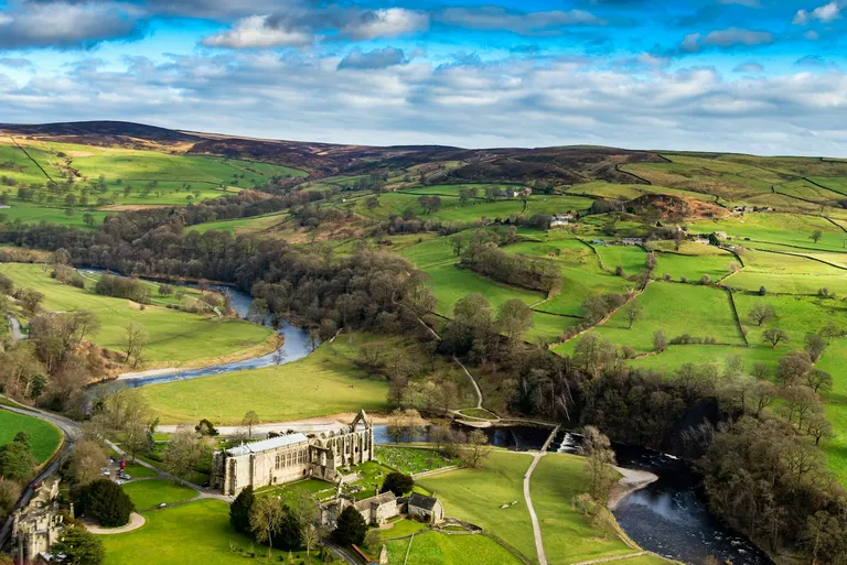
Bolton Priory Both are communities of monks or nuns. An abbey was headed by an abbot or abbess; a priory by a prior or prioress, and was often smaller or run from a mother house elsewhere. Henry VIII closed every one in England and Wales between 1536 and 1541 (the Dissolution of the Monasteries), sold off the land and stripped the buildings, which is why so many survive as beautiful ruins. In Scotland the abbeys faded away after the Reformation of 1560.
For example: Bolton Priory , Canterbury Cathedral , St Albans Cathedral , Westminster Abbey
- Friary
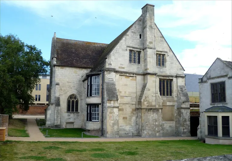
Blackfriars, Gloucester A house of friars: members of orders who lived by preaching and begging in towns rather than shutting themselves away like monks. The main orders were known by the colour of their robes, which is where town names like Greyfriars (Franciscans), Blackfriars (Dominicans) and Whitefriars (Carmelites) come from.
For example: Blackfriars, Gloucester, Greyfriars, Gloucester, Denbigh Friary, Blackfriars, St Andrews
- Preceptory
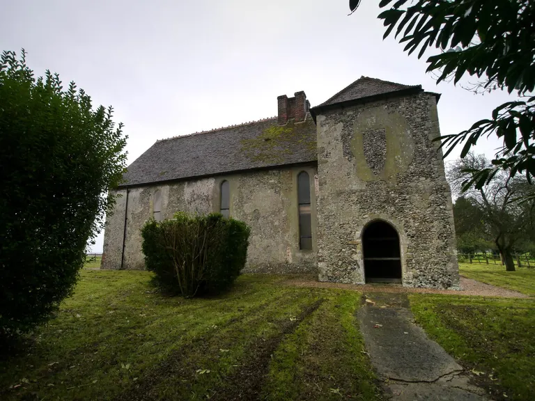
St John's Commandery, Swingfield A country estate and base of the crusading orders of knights, the Knights Templar and the Knights Hospitaller, which raised money to support the fighting in the Holy Land.
For example: St John's Commandery, Swingfield, Penhill Knights Templar preceptory, St John's Jerusalem, Charterhouse lead works
- Cistercian
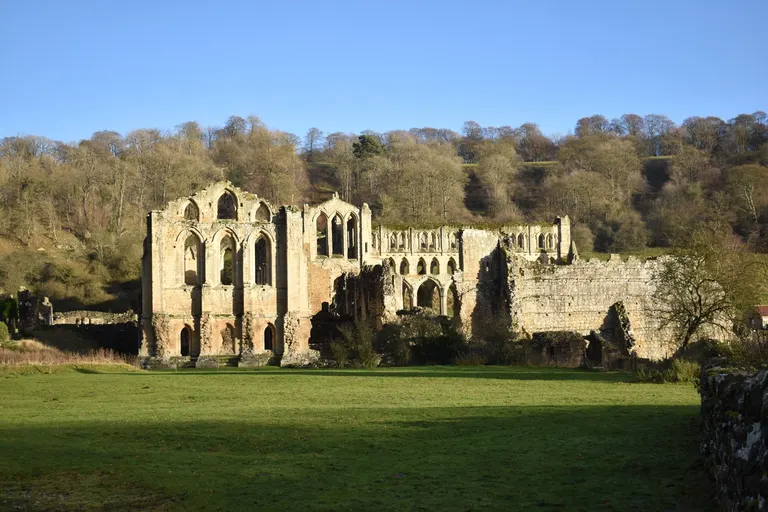
Rievaulx Abbey An order of monks, known as white monks for their undyed habits, who sought out remote valleys and became great sheep farmers. They built many of Britain's grandest abbeys, including Fountains, Rievaulx and Tintern.
For example: Rievaulx Abbey , Furness Abbey , Byland Abbey , Roche Abbey
- Benedictine
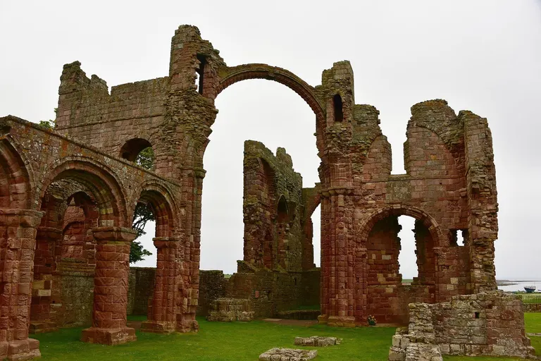
Lindisfarne Priory The oldest and largest order of monks, known as black monks, following the rule of St Benedict. Many of England's cathedrals, including Canterbury and Durham, were once run by Benedictine monks.
For example: Lindisfarne Priory , Whitby Abbey , Malmesbury Abbey , Abbotsbury Abbey remains
- Augustinian
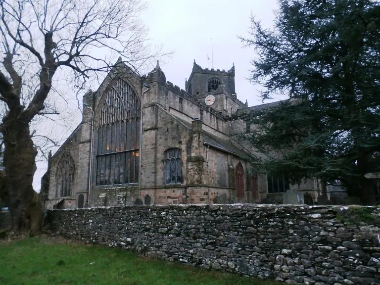
Cartmel Augustinian Priory Canons rather than monks: priests living together under a rule, who often ran parish churches and hospitals. They had more houses than any other order in medieval England.
For example: Cartmel Augustinian Priory , St Botolph's Priory, Colchester, Notley Abbey, Thornton Abbey
- Carthusian
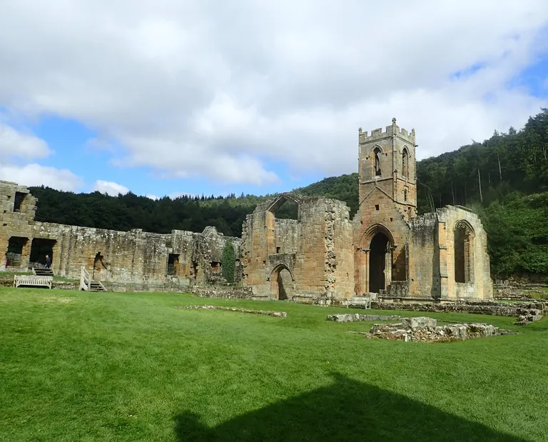
Mount Grace Priory The strictest of the orders. Each monk lived almost alone in his own small house and garden, meeting the others only for some services. Mount Grace Priory in North Yorkshire has one of these cells rebuilt so you can see how they lived.
For example: Mount Grace Priory , Axholme Carthusian Priory, Beauvale Carthusian Priory, Charterhouse Camp
- Cathedral
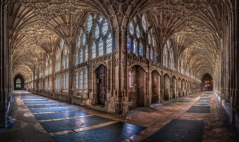
Gloucester Cathedral The main church of a diocese, holding the bishop's throne (the cathedra that gives it its name). Size has nothing to do with it: some cathedrals are smaller than big parish churches.
For example: Gloucester Cathedral , Lincoln Cathedral , Wells Cathedral , Winchester Cathedral
- Holy well
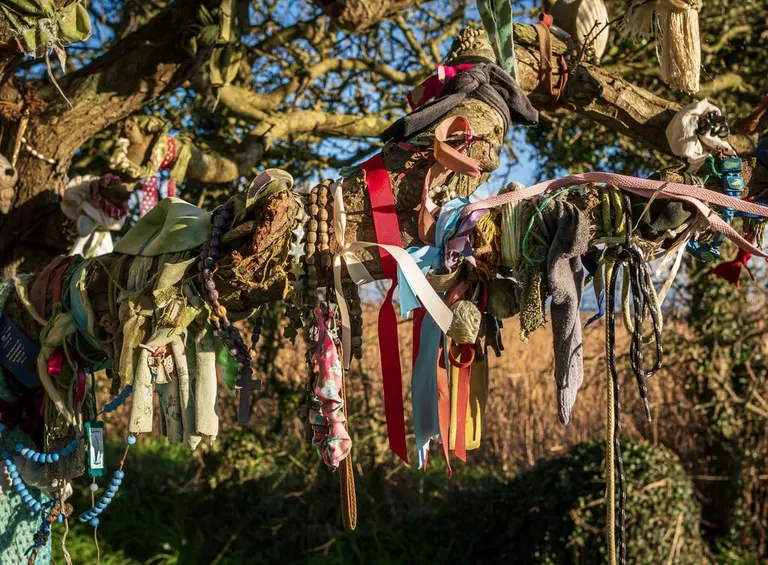
Clootie Well A spring or well linked with a saint, often visited for healing. Many are still decorated with offerings, and the tradition of tying cloths to nearby trees survives in places.
For example: Clootie Well , Chalice Well , Dupath Well, St Cybi's Well
Landscape words
Britain's place names are full of old words for hills, water and valleys, many borrowed from the Vikings in the north. A few you'll meet all the time.
For why the land takes these shapes in the first place, from chalk downs to granite tors, see Why Britain looks the way it does.
| The thing | English | Welsh | Scottish Gaelic & Scots | Regional English |
|---|---|---|---|---|
| Lake | lake | llyn | loch | mere, water (Wast Water) |
| Small mountain lake | pool | llyn (llyn bach) | lochan | tarn |
| Mountain | mountain | mynydd | beinn, ben | fell |
| Rounded hill | hill | moel | meall; law (Scots) | down |
| Sharp rocky peak | peak | crib (a sharp ridge) | sgùrr | pike |
| Head or top | head | pen (Pen y Fan) | ceann, kin- (Kinloch) | — |
| Ridge | ridge | crib, cefn | druim, drum- | edge, rigg |
| Pass | pass | bwlch | bealach | hause (Esk Hause) |
| Narrow valley | valley | cwm, nant | gleann, glen | clough, gill |
| Broad valley | vale | dyffryn | srath, strath | dale |
| Glacial hollow | corrie | cwm | coire | cove (Brown Cove) |
| Crag | crag, rock | craig | creag | scar, tor |
| Cairn | cairn | carn, carnedd | càrn | raise (Dunmail Raise) |
| Moorland | moor, heath | rhos | monadh | moss (bog), fell |
| Stream | stream, brook | nant | allt; burn (Scots) | beck, gill, bourne |
| River | river | afon | abhainn | — |
| Waterfall | waterfall | rhaeadr, pistyll | eas; linn (Scots) | force, spout |
| River mouth | mouth | aber (Aberystwyth) | inbhir, inver- (Inverness) | — |
| Island | island | ynys | eilean; innis, inch- (Inchcolm) | holm, -ey, eyot |
| Headland | headland | penrhyn, trwyn | rubha; mull (Mull of Kintyre) | ness, nab |
| Bay or cove | bay, cove | bae, porth | bàgh, camas | wick (Norse, northern coasts), haven |
| Wood | wood | coed | coille | shaw, holt, hurst |
| Church | church | llan, eglwys | cill, kil- (Kilmartin) | kirk |
| Words inside namesWelsh adjectives often change their first letter after a noun, so mawr becomes fawr and coch becomes goch. | ||||
| Big | great, much | mawr (fawr) | mòr, more (Ben More) | — |
| Small | little | bach (fach) | beag, beg | — |
| Red | red | coch (goch: Crib Goch) | ruadh, dearg | — |
| Black or dark | black | du (ddu) | dubh, dhu | — |
| White or fair | white | gwyn, gwen (wyn, wen) | bàn, geal | — |
- Fell
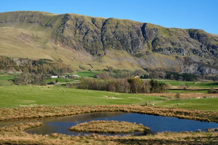
Blencathra A hill or mountain, especially open, unfenced upland in the Lake District and the Pennines. From the Old Norse word fjall.
For example: Blencathra , Ill Bell , Wetherlam , Scafell
- Force
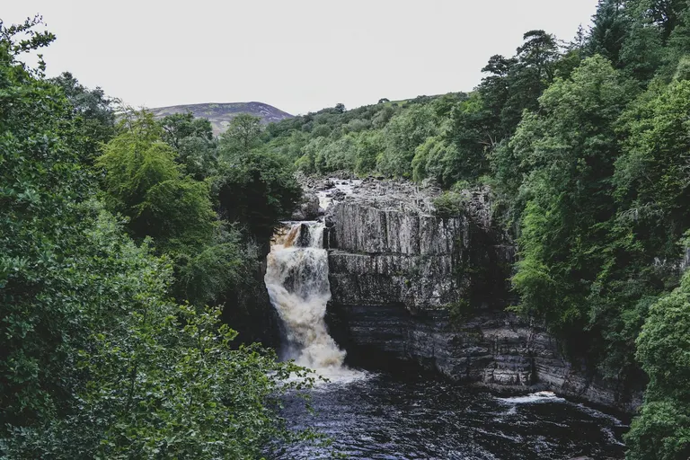
High Force A waterfall, in the north of England. From the Old Norse fors.
For example: High Force , Aira Force , Hardraw Force , Ashgill Force
- Beck
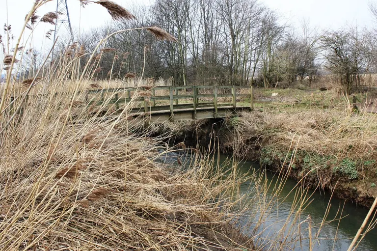
Billingham Beck Valley Country Park A stream, in northern England. From the Old Norse bekkr.
For example: Billingham Beck Valley Country Park, Caunton Beck, The Ship Inn (Barnoldby le Beck), Red Beck Top
- Gillghyll
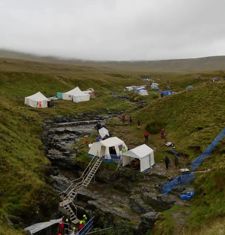
Gaping Gill A narrow ravine, usually with a stream in it, in northern England.
For example: Gaping Gill , Stock Ghyll Force , Dungeon Ghyll Force , East Gill Force
- Tarn
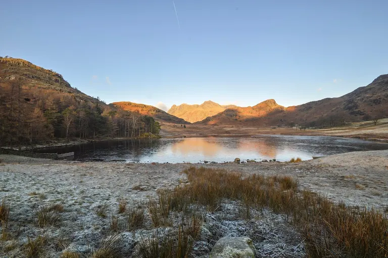
Blea Tarn A small mountain lake, often in a hollow scooped out by a glacier.
For example: Blea Tarn , Tarn Hows , Sprinkling Tarn , Devoke Water
- Mere
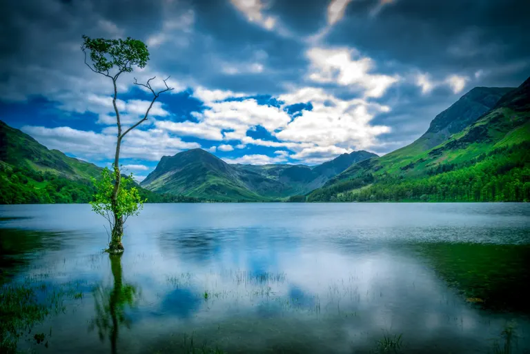
Buttermere A lake, usually one that's wide compared with its depth. In the Lake District most lakes are meres, waters or tarns: Bassenthwaite Lake is the only one of the main lakes with Lake in its name.
For example: Buttermere , Grasmere , Windermere
- Moor
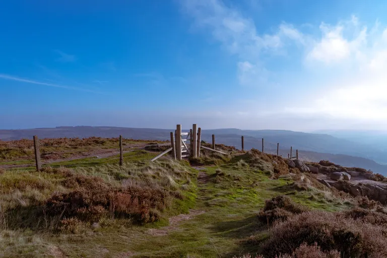
North York Moors High, open, unfenced land covered in heather, grass or bog, usually grazed by sheep and too wet or poor to farm.
For example: North York Moors , Widecombe-in-the-Moor , Ilkley Moor , Langsett Reservoir & Moors
- Downdowns, downland
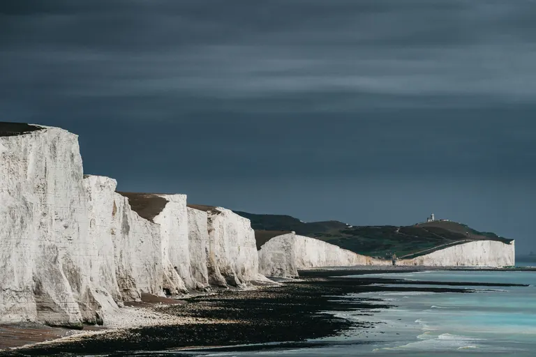
South Downs Rolling chalk hills with short grass, in southern England. It sounds backwards, but the word comes from the Old English dūn, meaning a hill, so the downs are uplands.
For example: South Downs , Watership Down , Brean Down , Kent Downs
- Wold
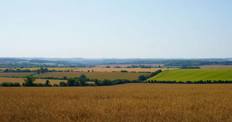
Lincolnshire Wolds Gently rolling open upland, as in the Cotswolds and the Lincolnshire and Yorkshire Wolds.
For example: Lincolnshire Wolds , Stow-on-the-Wold , Normanby le Wold Viewpoint, St Michael's Church, Garton-on-the-Wolds
- Dale
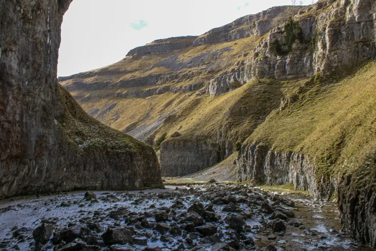
Gordale Scar A valley, especially in northern England, from the Old Norse dalr.
For example: Gordale Scar , Dovedale , Ennerdale Water , Borrowdale
- Combecoombe
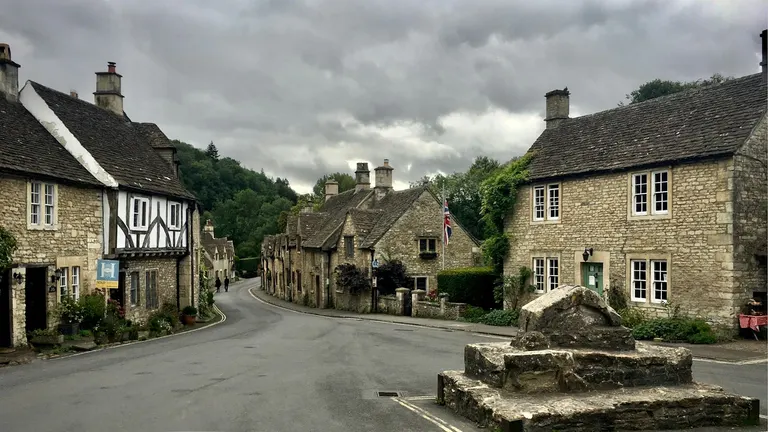
Castle Combe A short valley or a deep hollow in a hillside, common in the South West and on chalk. It's the same word as the Welsh cwm.
For example: Castle Combe , Combesgate Beach, Woolacombe , Burrington Combe , Hollycombe Steam Collection
- Tor
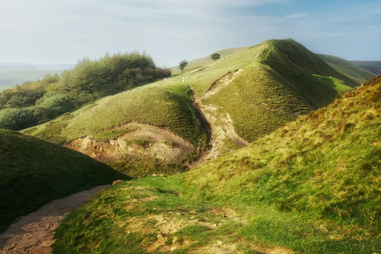
Mam Tor A rocky outcrop on top of a hill, especially the granite tors of Dartmoor and Bodmin Moor.
For example: Mam Tor , Glastonbury Tor , Hound Tor , Hound Tor Medieval Village
- Edge
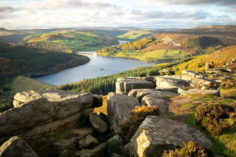
Bamford Edge A long line of cliffs or a steep escarpment along the side of a hill, like the gritstone edges of the Peak District.
For example: Bamford Edge , Stanage Edge , Wenlock Edge , Curbar Edge
- Scar
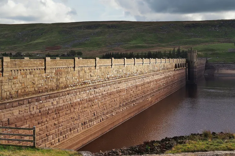
Scar House Reservoir A cliff or bare rocky face, often limestone, in northern England.
For example: Scar House Reservoir , White Scar Cave , Blackhope Scar, Nab Scar
- Pike
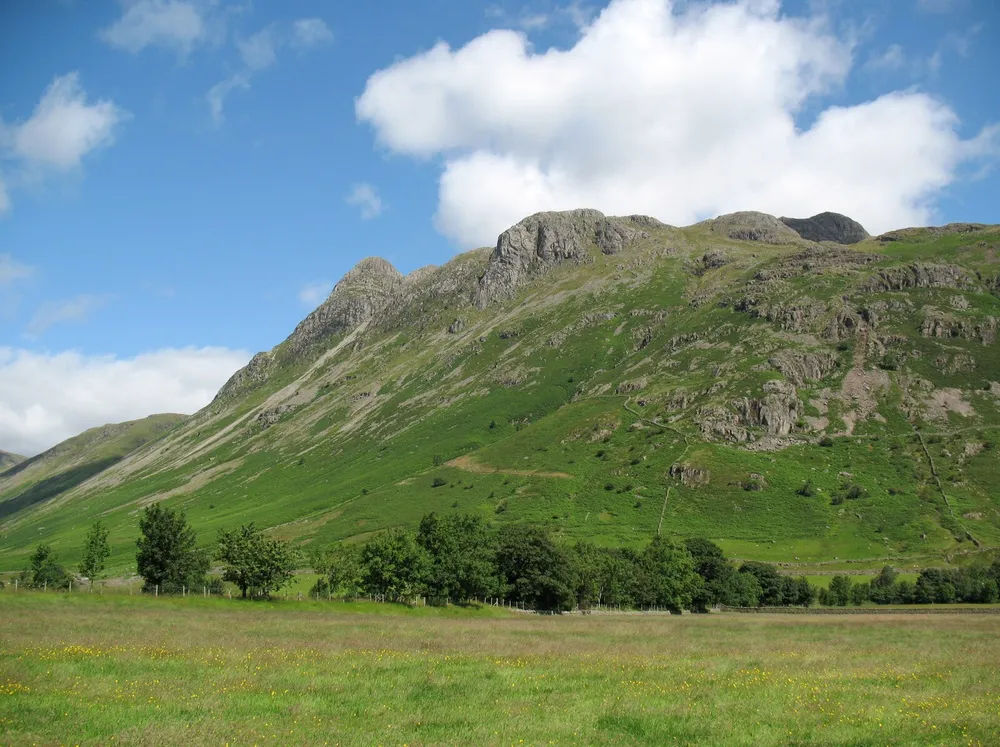
The Langdale Pikes A hill with a pointed summit, in northern England.
For example: Langdale Pikes, Whiteless Pike, Esk Pike, Nethermost Pike
- Fen
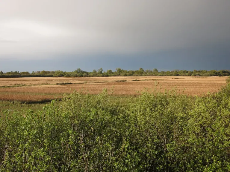
Wicken Fen Low, flat, wet land with peat soil, especially in East Anglia, much of it drained for farming since the 1600s.
For example: Wicken Fen , Flag Fen Archaeology Park , Fen Rivers Way, Fen Ditton
- Carr
Wet woodland of alder and willow growing on waterlogged ground.
- Broad
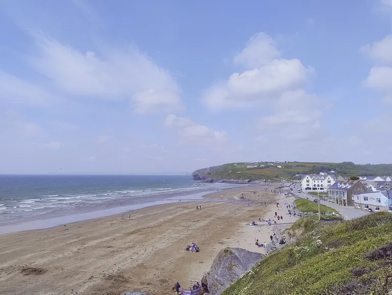
Broad Haven One of the shallow lakes of the Norfolk and Suffolk Broads. They were dug by people, not made by nature: medieval peat diggings that later flooded.
For example: Broad Haven , Broad Town White Horse , Barton Broad , Hickling Broad
- Heath
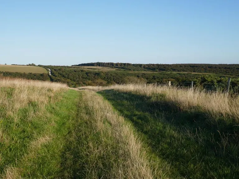
Lullington Heath Open land on poor, sandy soil, covered in heather, gorse and bracken. Britain has lost around 80% of its lowland heath since 1800, and much of what's left is protected.
For example: Lullington Heath, The Mutton at Hazeley Heath , Reigate Heath Windmill , Dunwich Heath
- Chine
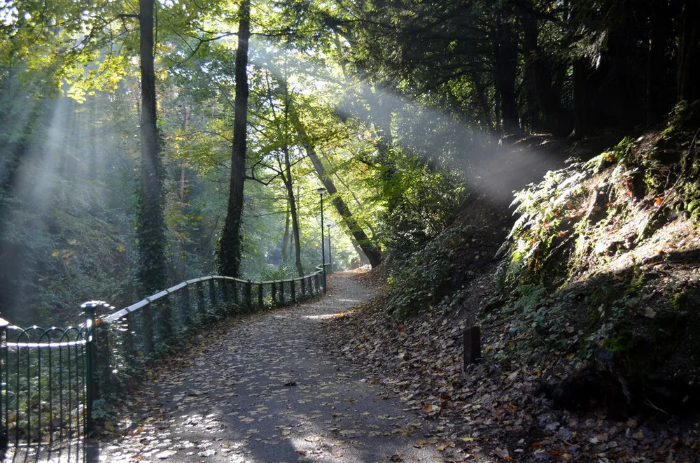
Alum Chine A steep, narrow ravine cut by a stream through soft cliffs to the sea, found on the Isle of Wight and around Bournemouth.
For example: Bournemouth Alum Chine, Bournemouth Durley Chine, Poole Branksome Chine, Poole Canford Cliffs Chine
- Ness
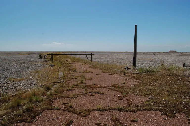
Orford Ness A headland, from the Old Norse nes. Loch Ness is the exception: it takes its name from the River Ness that drains it.
For example: Orford Ness , Dungeness , Tarbat Ness , Barns Ness
Scottish words
Most come from Gaelic, some from Scots or Old Norse.
- Loch
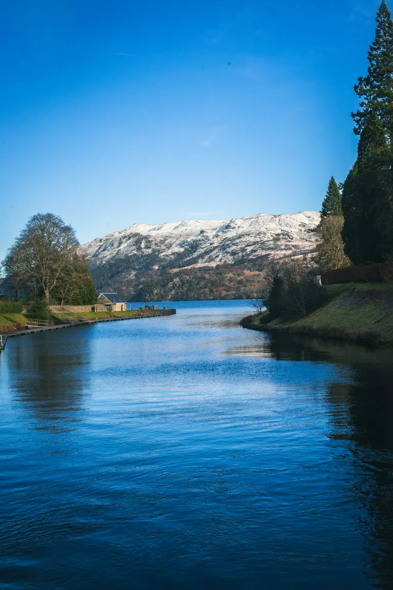
Loch Ness Scottish for lake. A sea loch is an arm of the sea running inland.
For example: Loch Ness , Loch an Eilein , Loch Katrine , Loch Lomond
- Lochan
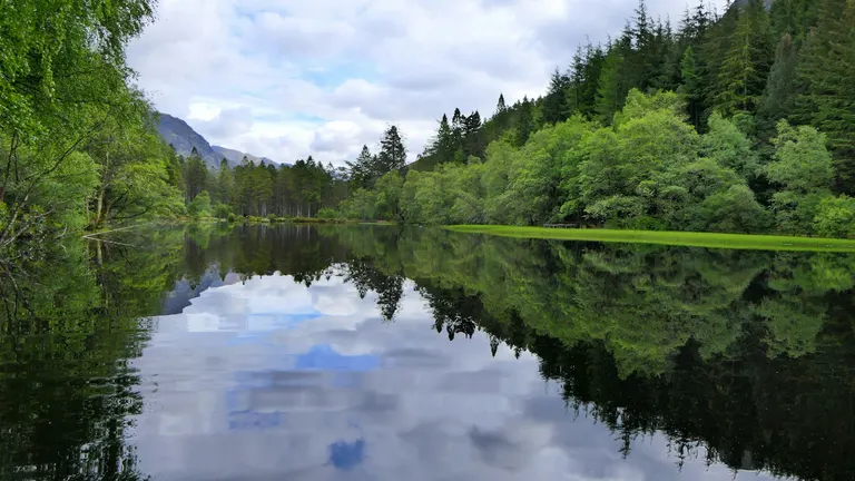
Glencoe Lochan A small loch.
For example: Glencoe Lochan , Lochan na h-Achlaise, Sgorr nan Lochan Uaine, Meall Lochan a' Chleirich
- Ben
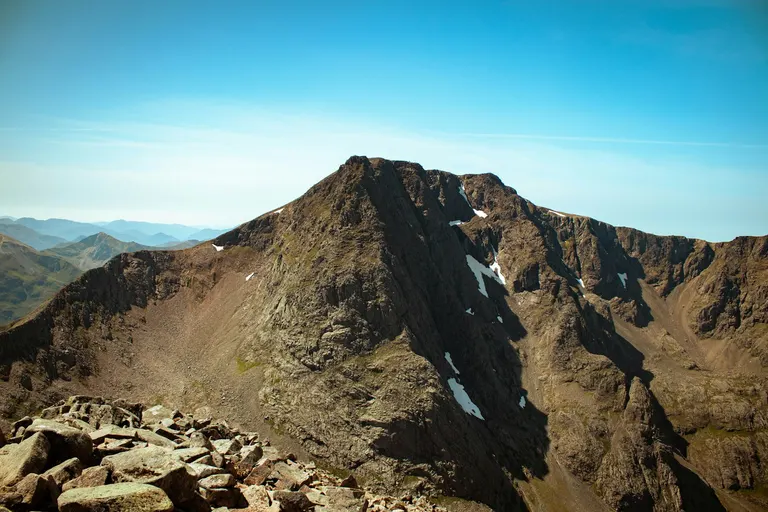
Ben Nevis A mountain, from the Gaelic beinn.
For example: Ben Nevis , Ben Lawers , Ben Alder , Ben Avon
- Glen
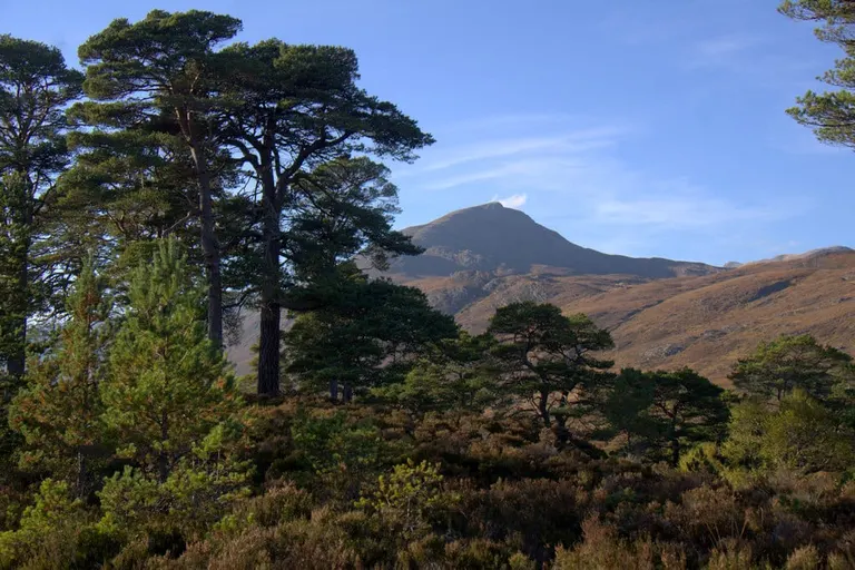
Glen Affric A long, narrow valley. A strath is a wider, flatter one.
For example: Glen Affric , St Nectan's Glen , Glen Etive , Fairlight Glen
- Burn
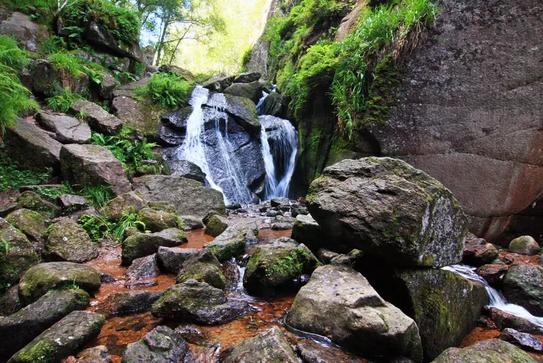
Burn o' Vat A stream.
For example: Burn o' Vat , Big Burn Waterfall, Burn Moor, Burn Valley Vineyard
- Linn
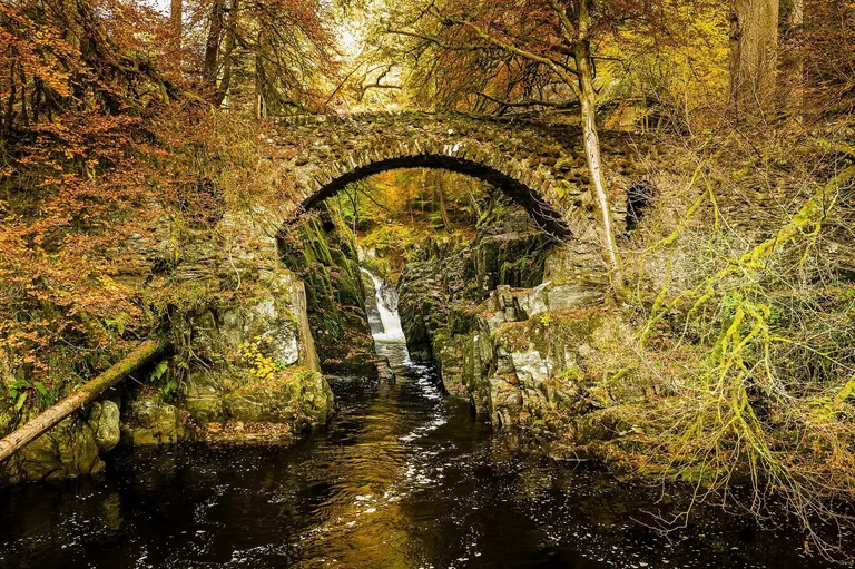
The Hermitage (Black Linn Falls) A waterfall, or the deep pool below one.
For example: The Hermitage (Black Linn Falls) , Linn of Dee , Davidson's Linn , Reekie Linn
- Corriecoire
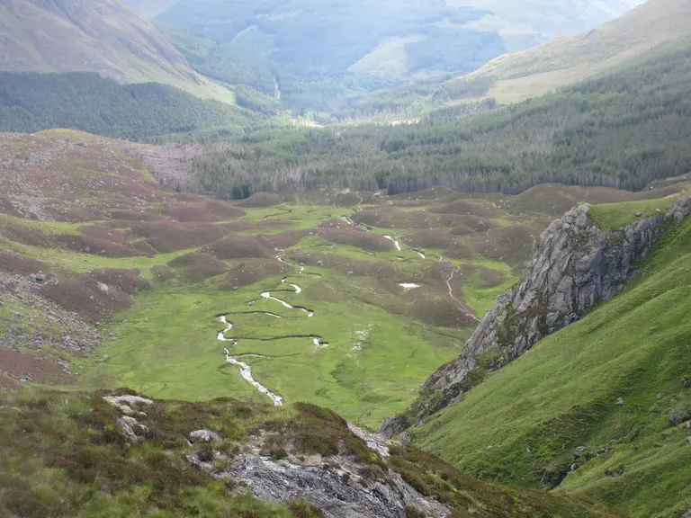
Corrie Fee A deep bowl carved into a mountainside by a glacier, often with a lochan in the bottom. Wales calls it a cwm.
For example: Corrie Fee , Stob Coire an Laoigh , Stob Coire Easain , Corrie
- Sgùrr
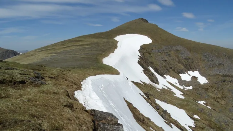
Sgurr Mor A sharp, rocky peak. The Skye Cuillin is full of them.
For example: Sgurr Mor , Sgurr na Lapaich , Sgurr nan Ceathramhnan , Sgurr nan Conbhairean
- Bealach
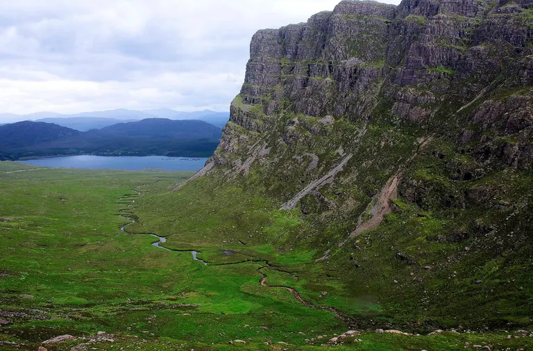
Bealach na Ba A mountain pass or the low point on a ridge between two summits.
For example: Bealach na Ba , Bealach Cafe
- Kyle
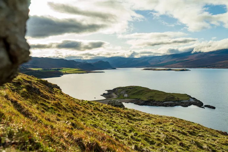
Kyle of Tongue A narrow strait between an island and the mainland, from the Gaelic caol.
For example: Kyle of Tongue , Kyle Line , The Plock of Kyle , Kyles of Bute
- Firth
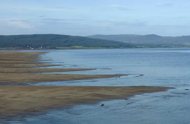
Dornoch Firth A wide sea inlet or estuary, like the Firth of Forth.
For example: Dornoch Firth, East Burra Firth, Aith Voe, Vassa Voe, Cat Firth, West Burra Firth
- Machair
Low, grassy plains behind the beaches of the Western Isles, built on windblown shell sand. In early summer they're covered in wild flowers.
For example: South Uist Machair
- Geo
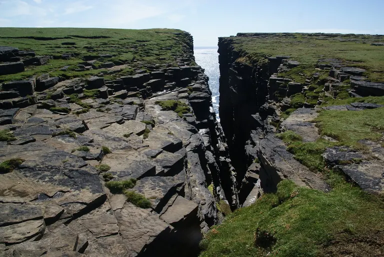
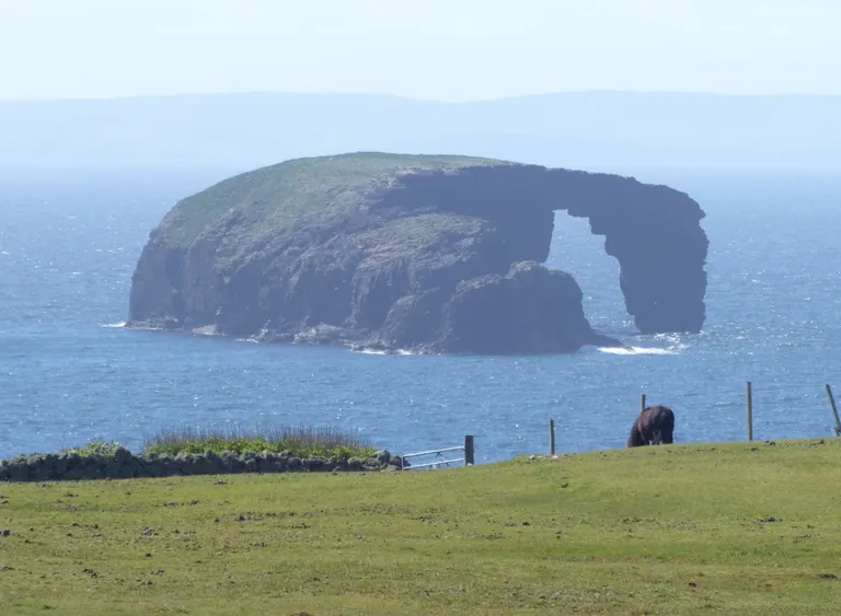
Ramni Geo A narrow inlet cut into sea cliffs, in Orkney and Shetland. From the Old Norse gjá.
For example: Ramni Geo
- Voe
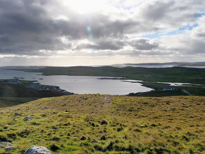
Whiteness Voe, Shetland A long, narrow sea inlet in Shetland.
For example: West Voe Beach , Voe, East Burra Firth, Aith Voe, Vassa Voe, Cat Firth
- Stacstack
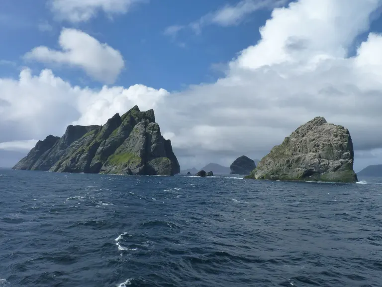
Stac Lee A steep pillar of rock. On the coast that means a sea stack, cut off from the cliffs by the waves, like Stac an Armin and Stac Lee off St Kilda, the two tallest in Britain. Inland, the Gaelic stac also names a steep, craggy hill, like Stac Pollaidh in the far north-west.
For example: Stac Lee , Stac an Armin , Stac Pollaidh , An Ruadh-Stac
Welsh words
- Llyn
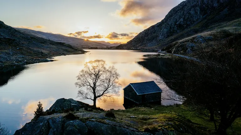
Llyn Idwal Welsh for lake.
For example: Llyn Idwal , Llyn Llygad Rheidol , Llynnau Mymbyr , Llyn Crafnant
- Cwm
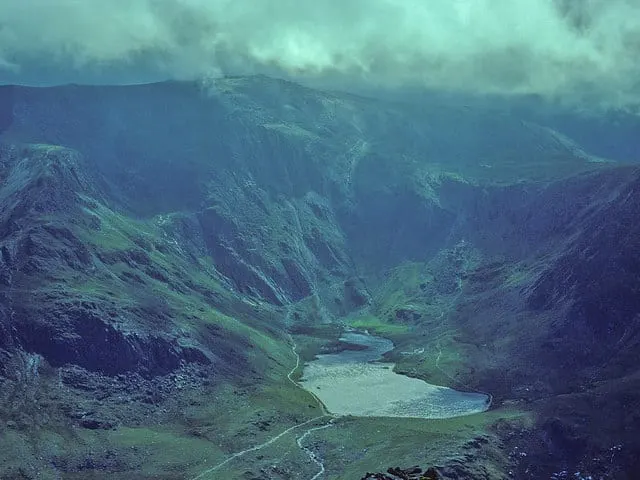
Cwm Idwal and Devil's Kitchen A valley, or a bowl carved out of a mountain by a glacier (the same thing Scotland calls a corrie).
For example: Cwm Idwal and Devil's Kitchen , Llyn Cwm Llwch , Cwm-yr-Eglwys , Parc Cwm Darran
- Rhaeadr
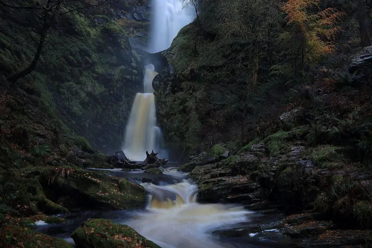
Pistyll Rhaeadr A waterfall.
For example: Pistyll Rhaeadr , Swallow Falls (Rhaeadr Ewynnol) , Rhaeadr Cynfal, Rhaeadr Du
- Pen
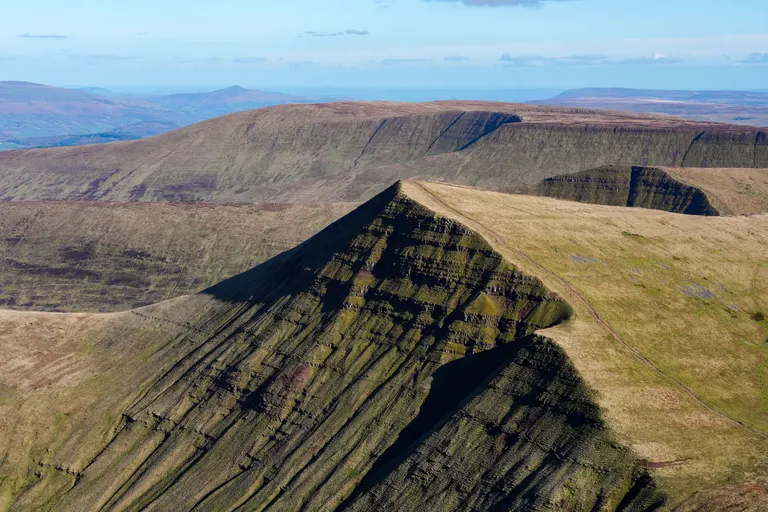
Pen y Fan Head, top or summit, as in Pen y Fan.
For example: Pen y Fan , Pen-y-ghent , Pen yr Ole Wen , Pen Llithrig y Wrach
- Moel
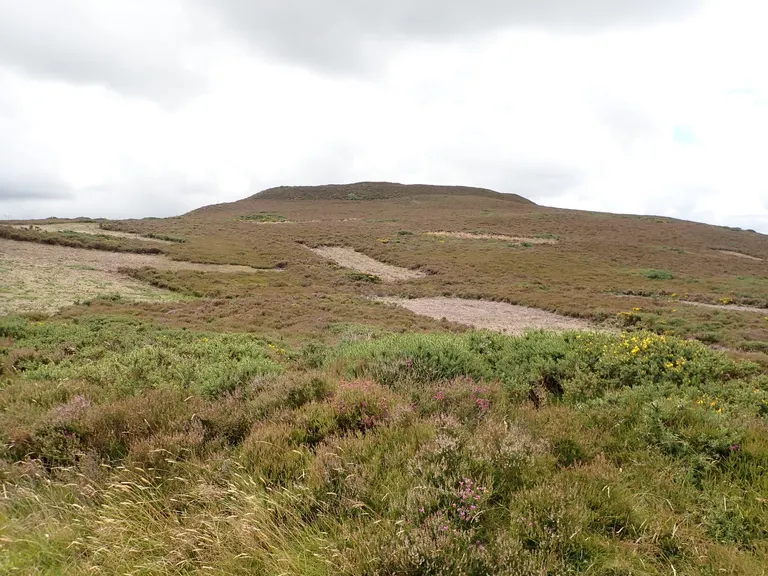
Moel Arthur A bare, rounded hill.
For example: Moel Arthur , Moel Hiraddug , Moel Siabod, Moel Sych
- Bwlch
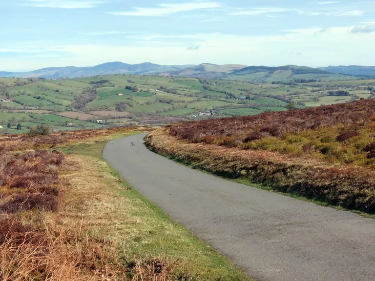
Bwlch y Groes A pass or gap between hills.
For example: Bwlch y Groes , Bwlch Nant yr Arian , Plas Tan y Bwlch, Bwlch y Geuffordd Gardens
- Carn and carnedd
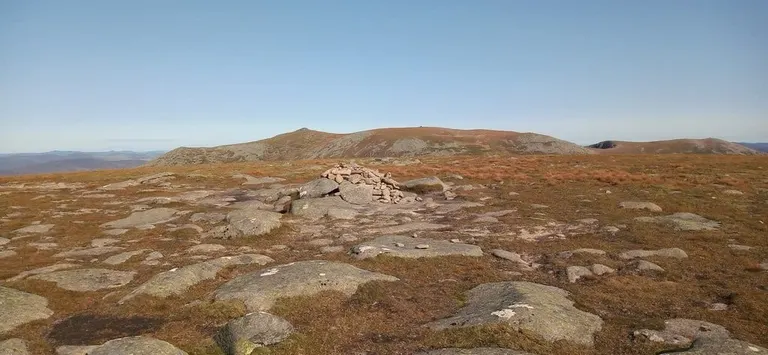
Carn a' Choire Bhoidheach A cairn, a pile of stones, and so often a hilltop with one on it.
For example: Carn a' Choire Bhoidheach , Carn Eighe , Carn Mor Dearg , Carnedd Dafydd
- Mynydd
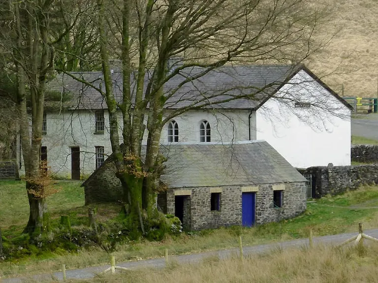
Capel Soar y Mynydd A mountain, or a stretch of upland moor.
For example: Capel Soar y Mynydd , Mynydd Moel, Mynydd Carningli, Mynydd Cilan
- Nant
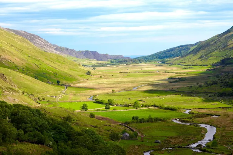
Nant Ffrancon Pass A stream or brook, and the small valley it runs through.
For example: Nant Ffrancon Pass , Nant-y-moch Reservoir , Morfa and Nant Bach, Nant-y-Bedd Garden
- Aber
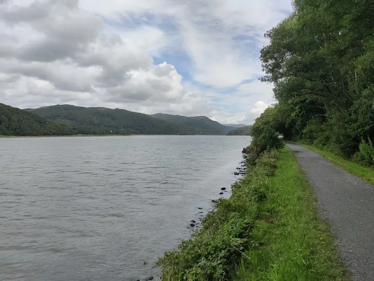
Mawddach Estuary A river mouth or confluence, as in Aberystwyth, the mouth of the Ystwyth. Barmouth's Welsh name, Abermaw, comes from the mouth of the Mawddach.
For example: Mawddach Estuary , Aber Falls , Aberffraw Bay , Aberdaron
- Porth
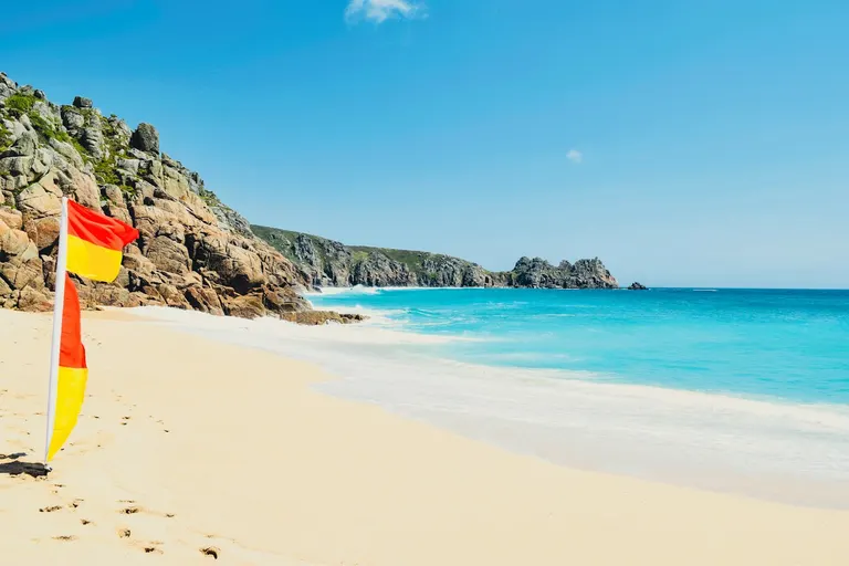
Porthcurno A harbour or cove.
For example: Porthcurno , Porth Ceiriad , Porth Dafarch , Porth Joke
- Ynys
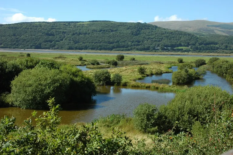
RSPB Ynys-hir An island.
For example: RSPB Ynys-hir , Ynys Tywyn, Ynys Leurad Hut Circles
- Eryri and Bannau Brycheiniog
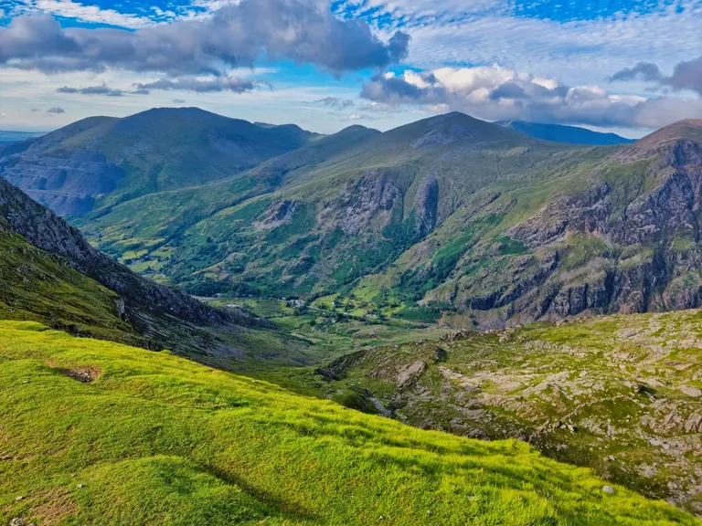
Eryri The Welsh names for Snowdonia and the Brecon Beacons, which both National Parks now use in English too. Yr Wyddfa is Snowdon itself.
For example: Eryri , Bannau Brycheiniog , Yr Wyddfa
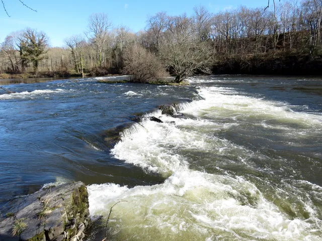
Photo credits
- National icon: Eilean Donan Castle, photo Sourav Bhaduri / Unsplash
- Local highlight: Steall Falls, © Ian Stewart / Geograph · CC BY-SA 2.0
- Local gem: Blakeney Guildhall, © Nicola J Patron / Wikimedia Commons · CC BY-SA 3.0
- Catalogued: Filsham Reedbed, © N Chadwick / Geograph · CC BY-SA 2.0
- Open access: Box Hill Country Park, © John P Reeves / Geograph · CC BY-SA 2.0
- Open to visitors: Eilean Donan Castle, photo Sourav Bhaduri / Unsplash
- Standing, ruins, earthworks or nothing visible: Bodiam Castle, photo Ar kay / Pexels
- National Park: Cairngorms, photo James Montgomerie / Unsplash
- National Landscape: Forest of Bowland, photo Robin Cross / Unsplash
- National Scenic Area: Ben Nevis and Glen Coe, photo Luis Mayoral / Unsplash
- Heritage Coast: St Bees Head, photo Ian Cylkowski / Unsplash
- Site of Special Scientific Interest: Brimham Rocks, © mattbuck / Wikimedia Commons · CC BY-SA 3.0
- National Nature Reserve: Corrieshalloch Gorge, photo Clément Proust / Pexels
- Country park: Bradgate Park and Swithland Woods, photo David Roberts / Pexels
- Ancient woodland: Wistman's Wood, © Ian Capper / Geograph · CC BY-SA 2.0
- RSPB reserve: Balranald RSPB Nature Reserve, © M J Richardson / Geograph · CC BY-SA 2.0
- Designated bathing water: Runswick Bay, photo David Bell / Pexels
- Lido: Bude Sea Pool, © Geni / Wikimedia Commons · CC BY-SA 4.0
- Right to roam: Dartmoor, photo Poppy Gitsham / Pexels
- World Heritage Site: Stonehenge, photo Kristian Thomas / Pexels
- Scheduled monument: Castlerigg stone circle, photo Pam Crane / Pexels
- Listed building: York Minster, photo Karl Moran / Unsplash
- Registered park and garden: Audley End House and Gardens, photo Ryan Thomas / Pexels
- Registered battlefield: Battle of Naseby, © Philip Halling / Geograph · CC BY-SA 2.0
- National Trust: Farne Islands, photo Lewis Ashton / Pexels
- Munro: Buachaille Etive Mòr (Stob Dearg), photo Ian Cylkowski / Unsplash
- Corbett: Caisteal Abhail, photo Ian Cylkowski / Unsplash
- Graham: Suilven, photo Chris Lines / Unsplash
- Donald: Ben Cleuch, © Richard Webb / Geograph · CC BY-SA 2.0
- Marilyn: Stiperstones, photo Ffion Scott / Pexels
- Hewitt: Cadair Idris, photo Lukas Hartmann / Pexels
- Nuttall: Great Gable, photo James Qualtrough 🇮🇲 / Unsplash
- Wainwright: Helvellyn, photo Heather Sheldrick / Unsplash
- Wainwright Outlying Fell: Pikes, photo James Qualtrough 🇮🇲 / Unsplash
- County top: Kinder Scout, photo Greg Willson / Unsplash
- Trig pillar: A trig pillar in the Peak District, photo Annette Lewis / Pexels
- National Trail: Hadrian's Wall Path, photo the iop / Pexels
- Scotland's Great Trail: Southern Upland Way, photo Michał Robak / Pexels
- Long-distance path: Wales Coast Path, photo Petra Nesti / Pexels
- Canal: Stratford-upon-Avon Canal, © Stephen McKay / Geograph · CC BY-SA 2.0
- River navigation: River Nene, © Tim Heaton / Geograph · CC BY-SA 2.0
- Stone circle: Tomnaverie, photo martin bennie / Unsplash
- Henge: Ring of Brodgar, photo David Bayliss / Unsplash
- Standing stone: Maen Llia, © don cload / Geograph · CC BY-SA 2.0
- Stone row: West Kennet Avenue, © Diliff / Wikimedia Commons · CC BY-SA 3.0
- Chambered tomb: Arthur's Stone, © Fabian Musto / Geograph · CC BY-SA 2.0
- Barrow: Silbury Hill, © Stevekeiretsu / Wikimedia Commons · CC BY-SA 4.0
- Cursus: Long Meg and Her Daughters, photo Valentine Kulikov / Pexels
- Rock art: Clava Cairns, photo Gene Samit / Pexels
- Hillfort: Maiden Castle, © Hadrianus1959 / Wikimedia Commons · CC BY-SA 4.0
- Promontory fort: Burghead Promontory and Well, © Mary and Angus Hogg / Geograph · CC BY-SA 2.0
- Broch: Dun Carloway, © David Dixon / Geograph · CC BY-SA 2.0
- Crannog: The Scottish Crannog Centre, © Richard Sutcliffe / Geograph · CC BY-SA 2.0
- Souterrain: Ardestie Souterrain, © Sandy Gerrard / Geograph · CC BY-SA 2.0
- Pictish stone: Aberlemno, © Scott Cormie / Geograph · CC BY-SA 2.0
- Flint mine: Grime's Graves, © Christine Johnstone / Geograph · CC BY-SA 2.0
- Roman fort: Hardknott Roman fort, © John H Darch / Geograph · CC BY-SA 2.0
- Roman villa: Chedworth Roman villa, © Steve Daniels / Geograph · CC BY-SA 2.0
- Frontier wall: Cawfields Roman Wall, © Sebastian Mierzwa / Wikimedia Commons · CC BY-SA 4.0
- Milecastle: Housesteads fort, © Ruth Riddle / Geograph · CC BY-SA 2.0
- Signal station: Pike Hill Signal Tower, © Mertbiol / Wikimedia Commons · CC0
- Motte and bailey: Dunster Castle, photo Ray Harrington / Unsplash
- Ringwork: Helmsley Castle, © Stevekeiretsu / Wikimedia Commons · CC BY-SA 4.0
- Tower house: Castle Stalker, photo h1ghland_fox - / Pexels
- Artillery fort: Deal Castle, © DeFacto / Wikimedia Commons · CC BY-SA 4.0
- Abbey and priory: Bolton Priory, photo James Genchi / Unsplash
- Friary: Blackfriars, Gloucester, © Philafrenzy / Wikimedia Commons · CC0
- Preceptory: St John's Commandery, Swingfield, © Chris Gunns / Geograph · CC BY-SA 2.0
- Cistercian: Rievaulx Abbey, photo Lewis Ashton / Pexels
- Benedictine: Lindisfarne Priory, © August Schwerdfeger / Wikimedia Commons · CC BY 4.0
- Augustinian: Cartmel Augustinian Priory, © Anthony Parkes / Geograph · CC BY-SA 2.0
- Carthusian: Mount Grace Priory, © Marathon / Geograph · CC BY-SA 2.0
- Cathedral: Gloucester Cathedral, © Christopher JT Cherrington / Wikimedia Commons · CC BY-SA 4.0
- Holy well: Clootie Well, © Rossographer / Geograph · CC BY-SA 2.0
- Fell: Blencathra, photo Rodion Kutsaiev / Pexels
- Force: High Force, photo Lawrence Reynolds / Unsplash
- Beck: Billingham Beck Valley Country Park, © Philip Barker / Geograph · CC BY-SA 2.0
- Gill: Gaping Gill, © habiloid / Geograph · CC BY-SA 2.0
- Tarn: Blea Tarn, © Tim Watts / Wikimedia Commons · CC BY 2.0
- Mere: Buttermere, photo Jonny Gios / Unsplash
- Moor: North York Moors, photo ANA TINCA / Pexels
- Down: South Downs, photo Andras Stefuca / Pexels
- Wold: Lincolnshire Wolds, photo Mike Bird / Pexels
- Dale: Gordale Scar, photo James Maxfield / Unsplash
- Combe: Castle Combe, photo Olivier Collet / Unsplash
- Tor: Mam Tor, photo Ian Cylkowski / Unsplash
- Edge: Bamford Edge, photo Zhi Xuan Hew / Unsplash
- Scar: Scar House Reservoir, © Kreuzschnabel / Wikimedia Commons · CC BY-SA 3.0
- Pike: The Langdale Pikes, © Adrian Taylor / Geograph · CC BY-SA 2.0
- Fen: Wicken Fen, © Hugh Venables / Geograph · CC BY-SA 2.0
- Broad: Broad Haven, © Celuici / Wikimedia Commons · CC0
- Heath: Lullington Heath, © Stefan Czapski / Geograph · CC BY-SA 2.0
- Chine: Alum Chine, © Rod Grealish / Geograph · CC BY-SA 2.0
- Ness: Orford Ness, © Draco2008 / Wikimedia Commons · CC BY 2.0
- Holm: Dore Holm, © Russel Wills / Geograph · CC BY-SA 2.0
- Loch: Loch Ness, photo Adam King / Unsplash
- Lochan: Glencoe Lochan, photo David White / Unsplash
- Ben: Ben Nevis, photo Jack Skinner / Unsplash
- Glen: Glen Affric, © Mike Pennington / Geograph · CC BY-SA 2.0
- Burn: Burn o' Vat, © Alan Findlay / Geograph · CC BY-SA 2.0
- Linn: The Hermitage (Black Linn Falls), © Ian Dick / Wikimedia Commons · CC BY 2.0
- Corrie: Corrie Fee, © Scott Cormie / Geograph · CC BY-SA 2.0
- Sgùrr: Sgurr Mor, © Colin Park / Geograph · CC BY-SA 2.0
- Bealach: Bealach na Ba, © brian gillman / Wikimedia Commons · CC BY 3.0
- Kyle: Kyle of Tongue, photo Michał Robak / Pexels
- Firth: Dornoch Firth, © Claire Pegrum / Geograph · CC BY-SA 2.0
- Geo: Ramni Geo, © Bill Boaden / Geograph · CC BY-SA 2.0
- Voe: Whiteness Voe, Shetland, © David Dixon / Geograph · CC BY-SA 2.0
- Stac: Stac Lee, © James Allan / Geograph · CC BY-SA 2.0
- Llyn: Llyn Idwal, photo Nick Russill / Unsplash
- Afon: Afon Gwy, the River Wye, in Powys, © Alan Richards / Geograph · CC BY-SA 2.0
- Cwm: Cwm Idwal and Devil's Kitchen, © GP Williams / Geograph · CC BY-SA 2.0
- Rhaeadr: Pistyll Rhaeadr, © Charlie Marshall / Wikimedia Commons · CC BY 2.0
- Pen: Pen y Fan, photo guo fengrui / Pexels
- Moel: Moel Arthur, © Eirian Evans / Geograph · CC BY-SA 2.0
- Bwlch: Bwlch y Groes, © Alan Richards / Geograph · CC BY-SA 2.0
- Carn and carnedd: Carn a' Choire Bhoidheach, © Iain Russell / Geograph · CC BY-SA 2.0
- Mynydd: Capel Soar y Mynydd, © Roger D Kidd / Geograph · CC BY-SA 2.0
- Nant: Nant Ffrancon Pass, © Andrew Woodvine / Geograph · CC BY-SA 2.0
- Aber: Mawddach Estuary, © Mat Fascione / Geograph · CC BY-SA 2.0
- Porth: Porthcurno, photo BEN ELLIOTT / Unsplash
- Ynys: RSPB Ynys-hir, © Philip Halling / Geograph · CC BY-SA 2.0
- Eryri and Bannau Brycheiniog: Eryri, photo T6 Adventures / Pexels


