Some seventy-four miles up the River Wear, from the Sunderland coast to the Pennine dale head at Cowshill
Indicative — sampled from open terrain data along the simplified route.
The Weardale Way follows the River Wear for about 74 miles, from the sea at Roker in Sunderland inland to Cowshill, high in the west of County Durham. It traces the river the whole way, from the mouth on the Tyne and Wear coast up through the city and lowlands and on into the Pennines, gaining height steadily until it reaches the moorland head of the dale.
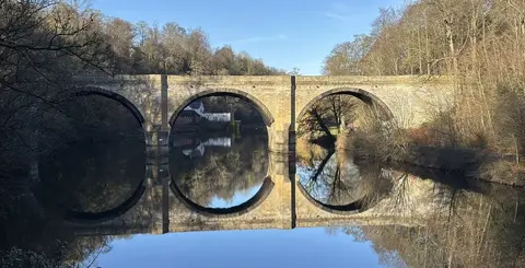
The lower half is easy, level walking beside a river that runs through parkland, old colliery country and the meadows below Durham. It passes Chester-le-Street, swings past Durham beneath its cathedral and castle, and goes on through Bishop Auckland. Beyond Wolsingham the valley narrows into Weardale proper, climbing past Frosterley, Stanhope and Wearhead into the North Pennines, where the country turns to rough grazing and heather and the lead-mining past is written all over the fells.
The going gets tougher as it climbs. The upper dale is exposed, and the final miles to Cowshill, near the old lead-mining site at Killhope, are hill walking rather than a riverside stroll. Four or five days covers the whole route.
The path links existing rights of way along the valley, following the Wear from sea to source. The lower half is well served by buses and by the stations around Durham and Sunderland, so those sections are easy to reach; the upper dale is quieter, with buses the main way in.