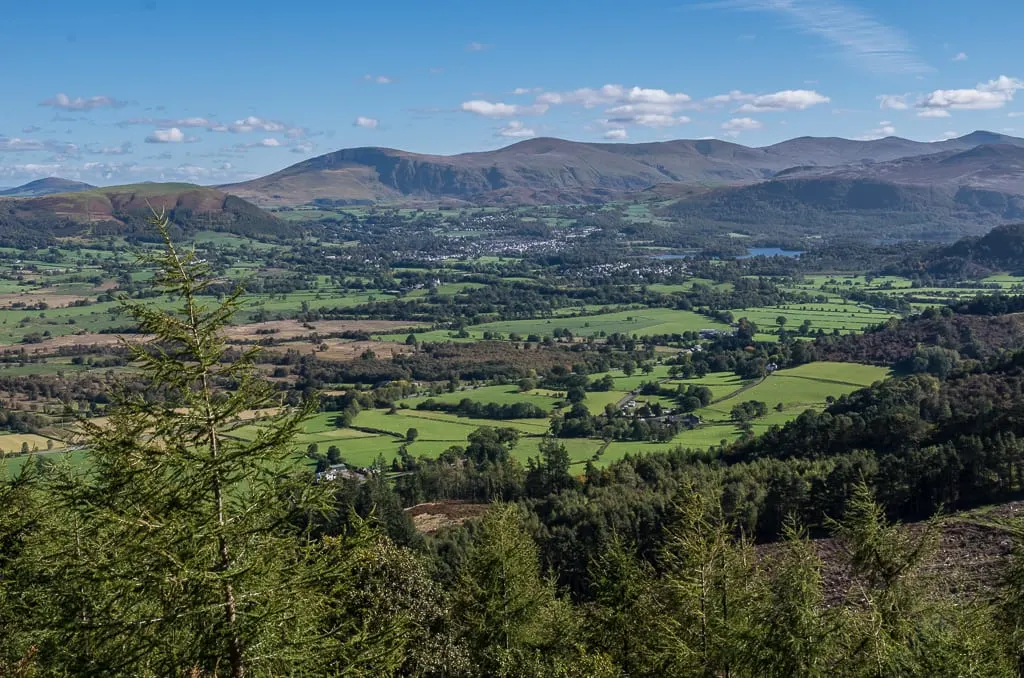
Nature reserves in CumbriaCumbria, England
268 nature reserves in the Albion Guide across Cumbria — see the full nature reserves directory, or everything to explore in Cumbria.
- Whinlatter Forest Park12 km²
- Elterwater0.36 km²
- Langdale Pikes4.7 km²
- Bardsea Country Park0.71 km²
- Dalemain Country Park0.34 km²
- Talkin Tarn Country Park0.62 km²
- Hell Gill0.01 km²
- Smardale Gill0.39 km²
- Bowness Common8 km²
- Fell Foot Country Park0.07 km²
- Longland Lake Country Park0.15 km²
- Troutbeck7.8 km²
- Far Arnside0.02 km²
- Drumburgh Moss1.2 km²
- Finglandrigg Woods0.88 km²
- Great Asby Scar3.1 km²
- Sandscale Haws2.6 km²
- Wetheral Woods
- Appleby Fells107 km²
- Armboth Fells23 km²
- Buttermere Fells61 km²
- Duddon Estuary68 km²
- Geltsdale & Glendue Fells81 km²
- Helvellyn & Fairfield25 km²
- Mallerstang-Swaledale Head62 km²
- Moorhouse and Cross Fell138 km²
- Morecambe Bay260 km²
- Shap Fells21 km²
- Skiddaw Group104 km²
- South Walney and Piel Channel Flats23 km²
- Upper Solway Flats & Marshes130 km²
- Moor House-Upper Teesdale87 km²
- Wild Ennerdale30 km²
- Ash Fell5.5 km²
- Ashgill Quarry1.6 km²
- Birk Fell2.7 km²
- Birkett Hill and High Out Wood0.58 km²
- Blea Water1 km²
- Brantrake Moss & Devoke Water1.3 km²
- Butterburn Flow4.2 km²
- Caudbeck Flow4.6 km²
- Claife Tarns and Mires1.5 km²
- Coniston Mines and Quarries1.3 km²
- Crosby Gill1.2 km²
- Crosby Ravensworth Fell15 km²
- Dodgson Wood1.3 km²
- Drigg Coast14 km²
- Duddon Valley Woodlands3.6 km²
- Eden Gorge1.4 km²
- Ennerdale3.4 km²
- Eycott Hill1.3 km²
- Farleton Knott2.9 km²
- Glasson Moss2.3 km²
- Greendale Mires0.85 km²
- Helbeck Wood0.91 km²
- Kirkby Moor (Cumbria)7.8 km²
- Langdale, Bowderdale and Carlin Gill18 km²
- Lazonby Fell3.3 km²
- Leck Beck Head Catchment Area6.9 km²
- Low Wood0.77 km²
- Ludderburn and Candlestick Mires1.4 km²
- Mungrisdale Mires1.1 km²
- Naddle Forest5.2 km²
- Pillar and Ennerdale Fells15 km²
- Ray and Crinkle Crags1.5 km²
- Rusland Valley Mosses0.94 km²
- Scafell Pikes11 km²
- Scout and Cunswick Scars3.7 km²
- Seatoller Wood and Sourmilk Gill1.4 km²
- Silloth Dunes and Mawbray Bank1.9 km²
- Spadeadam Mires11 km²
- Stonethwaite Woods0.99 km²
- Subberthwaite and Torver Low Commons19 km²
- Sunbiggin Tarn and Little Asby Scar10 km²
- The Clouds1.1 km²
- Thornsgill Beck and Wolf Crags0.98 km²
- Wan Fell3.1 km²
- Wasdale Screes3.4 km²
- Yewbarrow Woods1.1 km²
- Bolton Fell and Walton Mosses4.2 km²
- Borrowdale Rainforest7.2 km²
- Duddon Mosses1.2 km²
- Hutton Roof1.1 km²
- North Walney6.5 km²
- Roudsea Wood and Mosses4 km²
- South Solway Mosses9.7 km²
- Whitbarrow5.7 km²
- Annaside0.17 km²
- Ash Fell Edge0.08 km²
- Backside Beck and Spen Gill0.06 km²
- Barf and Thornthwaite0.23 km²
- Baysbrown Wood0.49 km²
- Beckfoot Quarry0.02 km²
- Beech Hill Wood0.3 km²
- Biglands Bog0.11 km²
- Birk Fell Hawse Mine0.02 km²
- Birky Cleugh0.03 km²
- Blelham Tarn & Bog0.51 km²
- Borrow Beck Meadows0.08 km²
- Bowness Knott0.4 km²
- Bramcrag Quarry & Wanthwaite Mine0.47 km²
- Browgill & Stockdale Becks0.27 km²
- Buckbarrow Beck0.02 km²
- Burns Beck Moss0.2 km²
- Castlehead Wood0.08 km²
- Cautley Thwaite Meadows0.48 km²
- Chapel Bridge Meadows0.03 km²
- Comb Beck0 km²
- Combe Scar0.21 km²
- Cropple How Mire0.09 km²
- Cumpston Hill0.04 km²
- Deepdale Meadows0.14 km²
- Ewefell Mire0.32 km²
- Foulshaw Moss3.5 km²
- Gelt Woods0.29 km²
- George Gill0.07 km²
- Glencoyne Wood0.3 km²
- Great Wood0.49 km²
- Hallinhag Wood0.16 km²
- High Lickbarrow Mires and Pastures0.2 km²
- Hollows Farm Section0.02 km²
- Irthing Gorge0.45 km²
- Johnny Wood0.36 km²
- Jumb Quarry0.02 km²
- Keisley Quarry0.08 km²
- Kershope Bridge0.06 km²
- Knipe Tarn0.06 km²
- Little Asby Inrakes and Outrakes0.12 km²
- Longsleddale Woods0.22 km²
- Loughrigg Fell Flushes0.14 km²
- Lyne Woods1.4 km²
- Meathop Moss0.68 km²
- Milkingstead Wood0.14 km²
- Millfield Verges0.02 km²
- Miterdale Head Wood0.05 km²
- Mollen Woods0.28 km²
- Murthwaite Park0.2 km²
- Nab Gill Mine0.05 km²
- Nichols Moss0.93 km²
- Orton Moss0.64 km²
- Outley Mosses0.34 km²
- Pets Quarry0.01 km²
- Pinskey Gill0.01 km²
- Pooley Bridge Section0.01 km²
- Pus Gill0.02 km²
- River Calder Section0.01 km²
- River Rawthey and Sally Beck0.44 km²
- Scaleby Moss0.69 km²
- Scales Wood0.54 km²
- Scandal Beck and Stone Gill0.12 km²
- Scawgill and Blaze Beck0.15 km²
- Seathwaite Copper Mines0.01 km²
- Shap Fell Road Cuttings0.17 km²
- Shaw Meadow & Sea Pasture0.09 km²
- Short Gill Cave System0.35 km²
- Side Pike0.1 km²
- Skelghyll Beck0.04 km²
- Skelwith Hill0.03 km²
- Smallcleugh Mine0.05 km²
- Stanley Ghyll0.08 km²
- Stile End0.06 km²
- Swindale Meadows0.08 km²
- Swindale Wood0.46 km²
- Tebay Road Cuttings0.1 km²
- Temple Sowerby Moss0.07 km²
- The Ings0.06 km²
- Thirlmere Woods0.46 km²
- Throstle Shaw and Sandbeds Fan0.03 km²
- Tilberthwaite Gill0.07 km²
- Underlaid Wood1.1 km²
- Unity Bog0.11 km²
- Upper Dentdale Cave System0.61 km²
- Wart Barrow0.26 km²
- White Moss, Crosbymoor0.38 km²
- Whitesike Mine and Flinty Fell0.08 km²
- Winster Wetlands0.4 km²
- Blelham Bog0.02 km²
- Clawthorpe Fell0.12 km²
- Cliburn Moss0.26 km²
- Gowk Bank0.15 km²
- Hallsenna Moor0.21 km²
- High Leys0.09 km²
- North Fen0.02 km²
- Rusland Moss0.24 km²
- Sandybeck Meadow0 km²
- Tarn Moss0.16 km²
- Thornhill Moss & Meadows0.12 km²
- Alston Shingle Banks0.17 km²
- Annaside and Gutterby Banks0.24 km²
- Argill Woods and Pastures0.28 km²
- Augill Valley Pasture0.03 km²
- Barker Scar0.18 km²
- Belah Woods and Pastures0.49 km²
- Black Moss0.16 km²
- Black Snib0.3 km²
- Blackdike Bog0.1 km²
- Blagill Mine0.01 km²
- Bothel Craggs Quarry0 km²
- Bowber Head and Piper Hole Meadows0.21 km²
- Braithwaite Moss0.34 km²
- Brathay Quarries0.25 km²
- Bretherdale Meadows0.12 km²
- Broad Dales0.16 km²
- Burrells Quarry0.01 km²
- Butterwick Meadows0.1 km²
- Cairnbridge Sand Pit0.02 km²
- Clints Crags, Blindcrake0.05 km²
- Clints Quarry (Cumbria)0.14 km²
- Clints Quarry, Moota0.12 km²
- Cotehill Pastures and Ponds0.1 km²
- Cowraik Quarry0.05 km²
- Cumwhitton Moss0.44 km²
- Drigg Holme0.09 km²
- Ellery Sike0.04 km²
- Elliscales Quarry0.01 km²
- Florence Mine0.27 km²
- Gill Beck0.03 km²
- Great Blencow Meadows and Fen0.08 km²
- Gribbs Meadows0.04 km²
- Haggs Bank0.02 km²
- Haile Great Wood0.32 km²
- Hale Moss0.03 km²
- Hale Moss Caves0.22 km²
- Harthwaite Sike0.01 km²
- Hollin Hill0.04 km²
- Iron Pit Spring Quarry0.01 km²
- Jenny Dam0.01 km²
- Jockie's Syke0.03 km²
- Lamonby Verges and Fields0.13 km²
- Little Langdale Tarn0.37 km²
- Little Mell Fell Quarry0 km²
- Low Beckside Meadow0.02 km²
- Low Church Moss0.05 km²
- Low Wray Bay0.04 km²
- Marble Quarry and Hale Fell0.43 km²
- Maryport Harbour0.04 km²
- Meathop Woods and Quarry0.39 km²
- Melmerby Road Section0 km²
- Middlebarrow0.18 km²
- Middlesceugh Woods and Pastures0.46 km²
- Moorthwaite Moss0.12 km²
- Mousegill Beck0.08 km²
- Newton Reigny Moss0.13 km²
- Oakshaw Ford0.06 km²
- Orton Pastures0.15 km²
- Oulton Moss0.24 km²
- Over Water0.3 km²
- Penton Linns0.08 km²
- Raisbeck Meadows0.14 km²
- River Nent at Blagill0.09 km²
- River South Tyne and Tynebottom Mine0.17 km²
- Salta Moss0.46 km²
- Scandal Beck, Brunt Hill0 km²
- Siddick Pond0.22 km²
- Silver Tarn, Hollas and Harnsey Mosses0.05 km²
- Skelsmergh Tarn0.04 km²
- Skelton Pasture0.12 km²
- Stagmire Moss0.08 km²
- Swindale Beck0.01 km²
- Thurstonfield Lough0.18 km²
- Town End Meadows, Little Asby0.11 km²
- Udford Low Moss0.17 km²
- Waberthwaite Quarry0.04 km²
- Wet Sleddale Meadows0.04 km²
- Whitberry Burn0.01 km²
- Wilson Place Meadows0.09 km²
- Yeathouse Quarry0.05 km²
- Yewdale Beck0.01 km²